Approximate Location Map
Large Map »
Latitude: 53.4057 / 53°24'20"N
Longitude: -2.9546 / 2°57'16"W
OS Eastings: 336631
OS Northings: 390303
OS Grid: SJ366903
Mapcode National: GBR 7BP.V4
Mapcode Global: WH877.LN7G
Plus Code: 9C5VC24W+74
Entry Name: 28, Marmaduke Street
Listing Date: 14 March 1975
Last Amended: 19 June 1985
Grade: II
Source: Historic England
Source ID: 1363070
English Heritage Legacy ID: 359077
ID on this website: 101363070
Location: Edge Hill, Liverpool, Merseyside, L7
County: Liverpool
Electoral Ward/Division: Picton
Parish: Non Civil Parish
Built-Up Area: Liverpool
Traditional County: Lancashire
Lieutenancy Area (Ceremonial County): Merseyside
Church of England Parish: Liverpool, All Saints
Church of England Diocese: Liverpool
Tagged with: Building
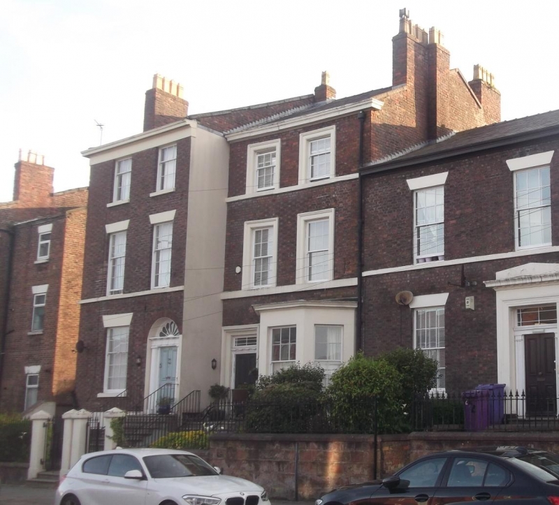
SJ 3690 MARMADUKE STREET
L7
28/739 No. 28 (formerly
listed with Nos.
14.3.75. 18 to 26 (even))
G.V. II
House. 1830's. Brick with stone dressings,slate roof, 3
storeys with basement, 2 bays. Basement lintel band; 1st
floor sill band; top frieze and cornice, Windows have wedge
lintels and are sashed, with some glazing bars. Round-headed
entrance has Doric doorcase (columns missing 1984) and
complete fanlight, 6-panel door.
Listing NGR: SJ3663190303
External links are from the relevant listing authority and, where applicable, Wikidata. Wikidata IDs may be related buildings as well as this specific building. If you want to add or update a link, you will need to do so by editing the Wikidata entry.


Other nearby listed buildings
