Approximate Location Map
Large Map »
Latitude: 51.304 / 51°18'14"N
Longitude: 0.4799 / 0°28'47"E
OS Eastings: 572966
OS Northings: 159016
OS Grid: TQ729590
Mapcode National: GBR PQS.25F
Mapcode Global: VHJM6.8HL6
Plus Code: 9F328F3H+HX
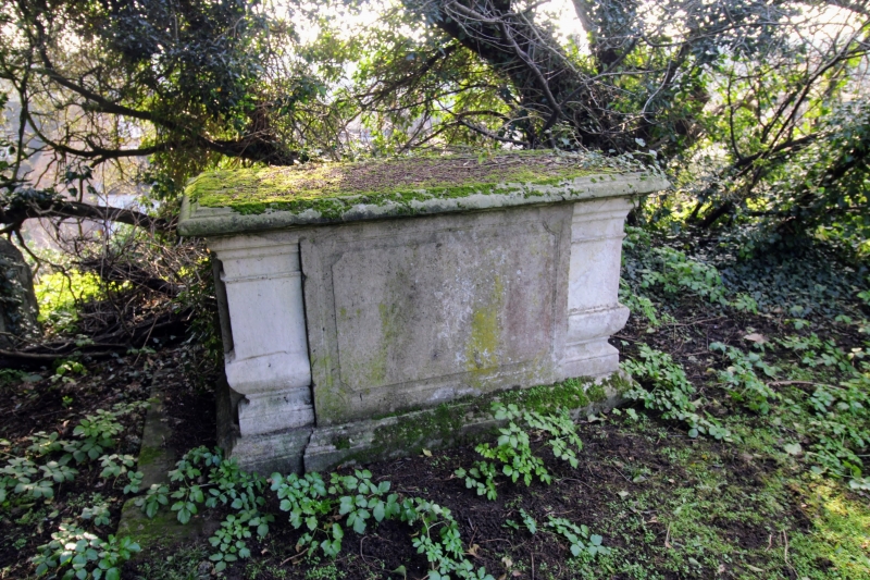
Entry Name: Chest tomb approximately 18 metres south east of Church of St Peter and St Paul
Listing Date: 25 February 1987
Grade: II
Source: Historic England
Source ID: 1363085
English Heritage Legacy ID: 179218
ID on this website: 101363085
Location: St Peter's Church, Aylesford, Tonbridge and Malling, Kent, ME20
County: Kent
District: Tonbridge and Malling
Civil Parish: Aylesford
Built-Up Area: Ditton
Traditional County: Kent
Lieutenancy Area (Ceremonial County): Kent
Church of England Parish: Aylesford St Peter and St Paul
Church of England Diocese: Rochester
Tagged with: Chest tomb
This list entry was subject to a Minor Amendment on 27/02/2019
TQ 7259
11/37
AYLESFORD CP
CHURCH LANE (north side)
Chest tomb approximately 18 metres south east of Church of St Peter and St Paul
(Formerly listed as Chest tomb 20 yards south-east of Aylesford Church, CHURCH LANE (north side))
GV
II
Chest tomb. Mid C18. Stone. Panelled sides, squared baluster corners. Inscription illegible at time of re-survey.
Listing NGR: TQ7296459017
External links are from the relevant listing authority and, where applicable, Wikidata. Wikidata IDs may be related buildings as well as this specific building. If you want to add or update a link, you will need to do so by editing the Wikidata entry.


Other nearby listed buildings
