Latitude: 51.2788 / 51°16'43"N
Longitude: 1.2778 / 1°16'40"E
OS Eastings: 628698
OS Northings: 158396
OS Grid: TR286583
Mapcode National: GBR VZN.RWC
Mapcode Global: VHLGR.34D0
Plus Code: 9F3377HH+G4
Entry Name: 57A and 57B, the Street
Listing Date: 26 November 1987
Grade: II
Source: Historic England
Source ID: 1363279
English Heritage Legacy ID: 178107
ID on this website: 101363279
Location: Ash, Dover, Kent, CT3
County: Kent
District: Dover
Civil Parish: Ash
Built-Up Area: Ash
Traditional County: Kent
Lieutenancy Area (Ceremonial County): Kent
Tagged with: Building
ASH TR 2858 THE STREET (south side) 10/77 Nos.57A, 57B GV II
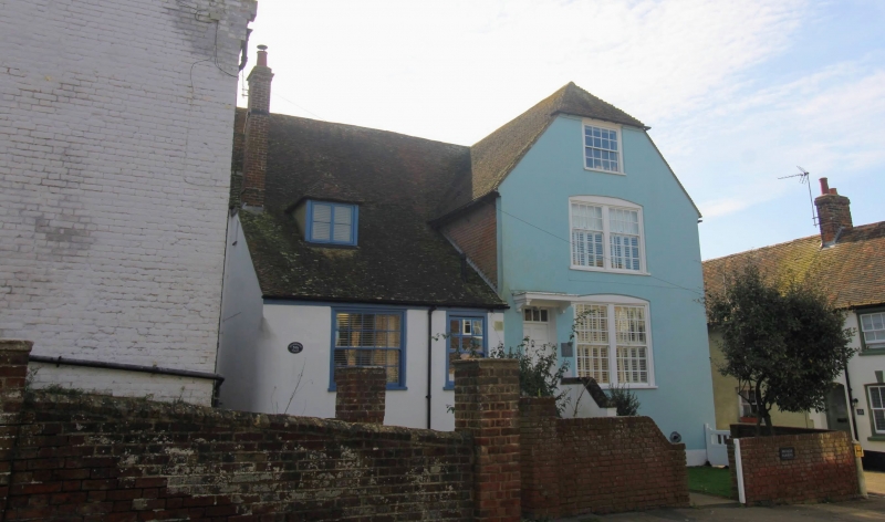
Three houses, sometime public house (The Ship Inn). C15, altered C18 to late C20. Timber framed and rendered with plain. tiled roof. Originally a hall house plan, now much altered. Main elevation: in 3 sections, 2 storeys to left, one storey and attic to centre and 3 storey with basement projecting half-hipped wing. Main range with hipped roof and stacks projecting at end right, to front left (paired) and to rear left. Irregular fenestration of glazing bar sashes to right, paired on first and ground floors, 2 glazing bar sashes and hipped dormer to centre, and wooden casement to left over carriageway with exposed framing. Door of 6 panels in right end wing with rectangular fanlight and flight of 5 steps. Half-glazed door also in left return. Rear elevation: clad in various coloured and bonded brickwork of different dates. Interior: full frame reported including dragon beams.
Listing NGR: TR2869858396
External links are from the relevant listing authority and, where applicable, Wikidata. Wikidata IDs may be related buildings as well as this specific building. If you want to add or update a link, you will need to do so by editing the Wikidata entry.


Other nearby listed buildings