Latitude: 51.3038 / 51°18'13"N
Longitude: 1.2275 / 1°13'39"E
OS Eastings: 625068
OS Northings: 161017
OS Grid: TR250610
Mapcode National: GBR VZD.C4F
Mapcode Global: VHLGJ.7H9D
Plus Code: 9F33863H+G2
Entry Name: House About 20 Metres South of Preston House
Listing Date: 26 November 1987
Grade: II
Source: Historic England
Source ID: 1363303
English Heritage Legacy ID: 178243
ID on this website: 101363303
Location: Preston, Dover, Kent, CT3
County: Kent
District: Dover
Civil Parish: Preston
Built-Up Area: Preston
Traditional County: Kent
Lieutenancy Area (Ceremonial County): Kent
Tagged with: House Thatched cottage
This list entry was subject to a Minor Amendment on 13 May 2026 to amend the name and address and reformat the text to current standards
TR 26 SE
2/212
PRESTON
THE STREET (west side)
Thatch Cottages, 1 and 2
(Formerly listed as House about 20 metres south of Preston House)
GV
II
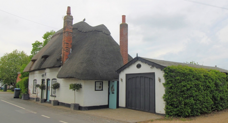
House, sometime cottage pair. Early C18. Painted brick and rendered left return, with thatched roof and plain tiled roof to rear wing. One storey and attic with hipped roof, two raking dormers with stacks to rear and at end right. Two segmental headed glazing bar sashes and two central boarded doors. Hipped extension to right. C20 glazed door in rear wing. Included for group value.
Listing NGR: TR2505561042
External links are from the relevant listing authority and, where applicable, Wikidata. Wikidata IDs may be related buildings as well as this specific building. If you want to add or update a link, you will need to do so by editing the Wikidata entry.


Other nearby listed buildings