Approximate Location Map
Large Map »
Latitude: 51.2267 / 51°13'36"N
Longitude: 1.4038 / 1°24'13"E
OS Eastings: 637749
OS Northings: 153006
OS Grid: TR377530
Mapcode National: GBR X1Y.1Q2
Mapcode Global: VHMDG.8FZG
Plus Code: 9F336CG3+MG
Entry Name: 7, Coppin Street
Listing Date: 8 February 1974
Grade: II
Source: Historic England
Source ID: 1363463
English Heritage Legacy ID: 177036
ID on this website: 101363463
Location: Deal, Dover, Kent, CT14
County: Kent
District: Dover
Civil Parish: Deal
Built-Up Area: Deal
Traditional County: Kent
Lieutenancy Area (Ceremonial County): Kent
Tagged with: Building
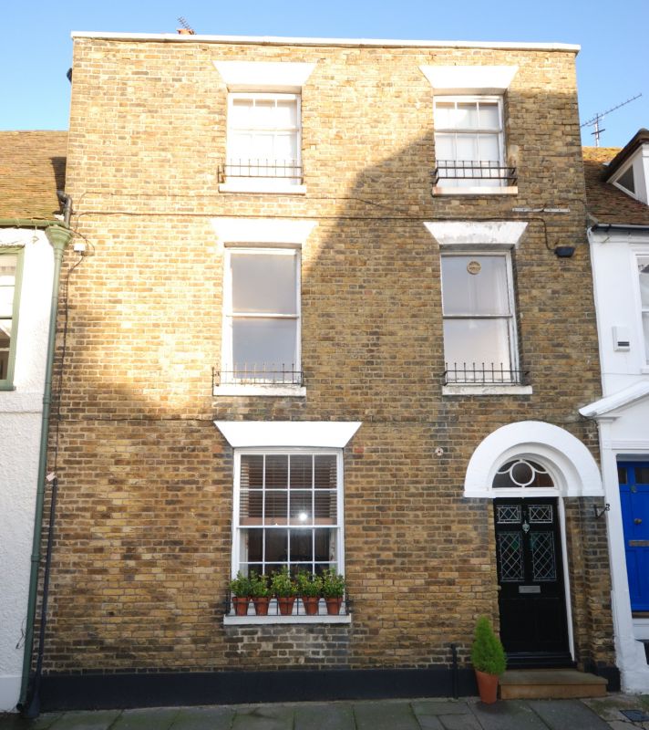
COPPIN STREET
1.
1035
(North Side)
No 7
TR 3752 NE 1/70
TR 3753 sE 2/70
II GV
2.
Early C19. 3 storeys yellow brick. Tuled roof. Parapet with stone coping.
2 sashes with most glazing bars missing. Right side round-headed doorcase with
fanlight.
Nos 1 to l0 (consec) form a group.
Listing NGR: TR3774953006
External links are from the relevant listing authority and, where applicable, Wikidata. Wikidata IDs may be related buildings as well as this specific building. If you want to add or update a link, you will need to do so by editing the Wikidata entry.


Other nearby listed buildings
