Approximate Location Map
Large Map »
Latitude: 51.4933 / 51°29'35"N
Longitude: -2.2812 / 2°16'52"W
OS Eastings: 380570
OS Northings: 177186
OS Grid: ST805771
Mapcode National: GBR 0P8.62X
Mapcode Global: VH962.DQVM
Plus Code: 9C3VFPV9+8G
Entry Name: Sunnyside
Listing Date: 9 December 1985
Grade: II
Source: Historic England
Source ID: 1363518
English Heritage Legacy ID: 317447
ID on this website: 101363518
Location: West Kington, Wiltshire, SN14
County: Wiltshire
Civil Parish: Nettleton
Traditional County: Wiltshire
Lieutenancy Area (Ceremonial County): Wiltshire
Church of England Parish: West Kington
Church of England Diocese: Bristol
Tagged with: Building
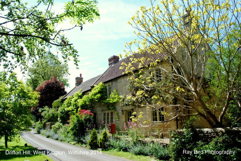
NETTLETON DRIFTON HILL
ST 87 NW
West Kington
2/355 sunnyside
II
House, dated 1824, rubble stone with Bridgwater tile roof, coped
gables and end wall stacks. 2 storeys, double fronted with stopped
cyma-moulded flush mullion windows and dripstones. Two 2-light
windows to first floor, one 3-light and one 2-light below with
central door in chamfered doorcase and datestone RB 1824 over.
Buttress against west corner. Lean-to against east end and rear
wall.
Listing NGR: ST8057077186
External links are from the relevant listing authority and, where applicable, Wikidata. Wikidata IDs may be related buildings as well as this specific building. If you want to add or update a link, you will need to do so by editing the Wikidata entry.


Other nearby listed buildings
