Approximate Location Map
Large Map »
Latitude: 51.4951 / 51°29'42"N
Longitude: -2.2263 / 2°13'34"W
OS Eastings: 384386
OS Northings: 177376
OS Grid: ST843773
Mapcode National: GBR 1QN.7YP
Mapcode Global: VH963.CPD6
Plus Code: 9C3VFQWF+2F
Entry Name: Hill House
Listing Date: 9 December 1985
Grade: II
Source: Historic England
Source ID: 1363577
English Heritage Legacy ID: 317192
ID on this website: 101363577
Location: Castle Combe, Wiltshire, SN14
County: Wiltshire
Civil Parish: Castle Combe
Traditional County: Wiltshire
Lieutenancy Area (Ceremonial County): Wiltshire
Church of England Parish: Castle Combe
Church of England Diocese: Bristol
Tagged with: House
CASTLE COMBE THE HILL
ST 8477
(west side)
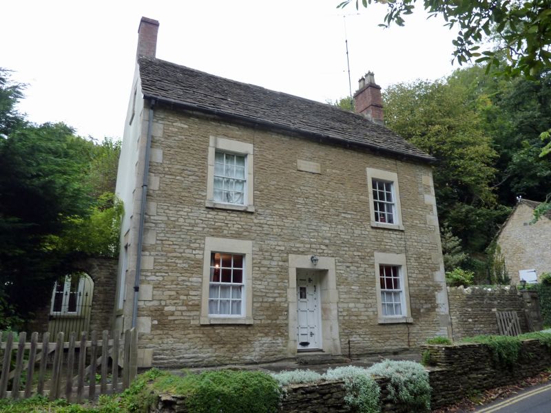
6/101 Hill House
II
House, dated 1823, coursed rubble stone with stone tiled roof and
end wall stacks. 2 storey, double fronted with two 12-pane sashes
to each floor and central door in trellis porch, all in flush stone
surrounds. Central plaque ANNO DOMINI MDCCCXXIII.
Listing NGR: ST8438677376
External links are from the relevant listing authority and, where applicable, Wikidata. Wikidata IDs may be related buildings as well as this specific building. If you want to add or update a link, you will need to do so by editing the Wikidata entry.


Other nearby listed buildings
