Approximate Location Map
Large Map »
Latitude: 51.5419 / 51°32'30"N
Longitude: -1.9041 / 1°54'14"W
OS Eastings: 406746
OS Northings: 182556
OS Grid: SU067825
Mapcode National: GBR 3T4.CDK
Mapcode Global: VHB3J.YH7V
Plus Code: 9C3WG3RW+P9
Entry Name: 139 and 139A, High Street
Listing Date: 15 August 1985
Grade: II
Source: Historic England
Source ID: 1363661
English Heritage Legacy ID: 316831
ID on this website: 101363661
Location: Royal Wootton Bassett, Wiltshire, SN4
County: Wiltshire
Civil Parish: Royal Wootton Bassett
Built-Up Area: Wootton Bassett
Traditional County: Wiltshire
Lieutenancy Area (Ceremonial County): Wiltshire
Church of England Parish: Wootton Bassett St Bartholomew and All Saints
Church of England Diocese: Salisbury
Tagged with: Building
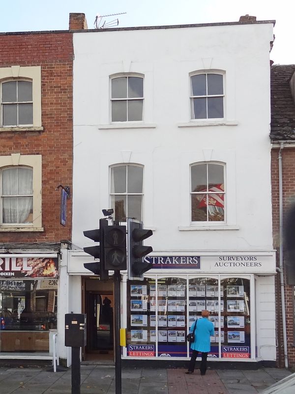
SU 08 SE WOOTTON BASSETT HIGH STREET
(south east side)
11/150 Nos 139 and 139a
GV II
House, now shop, early C19. Rendered brick and raised rendered
dressings. 3 storey, 2 bay central stack with No 138 (q.v.). C20
shop front to ground floor. Upper windows 4-pane sashes with
segmental heads and keystones. Facade raised as parapet.
Listed primarily for group value only with Nos. 136-141.
Listing NGR: SU0674282549
External links are from the relevant listing authority and, where applicable, Wikidata. Wikidata IDs may be related buildings as well as this specific building. If you want to add or update a link, you will need to do so by editing the Wikidata entry.


Other nearby listed buildings
