Approximate Location Map
Large Map »
Latitude: 51.5468 / 51°32'48"N
Longitude: -2.0511 / 2°3'4"W
OS Eastings: 396551
OS Northings: 183100
OS Grid: ST965831
Mapcode National: GBR 2RF.XZS
Mapcode Global: VHB3G.DDJ2
Plus Code: 9C3VGWWX+PH
Entry Name: Stable at Brook Farm
Listing Date: 25 November 1987
Grade: II
Source: Historic England
Source ID: 1363765
English Heritage Legacy ID: 316345
ID on this website: 101363765
Location: Great Somerford, Wiltshire, SN15
County: Wiltshire
Civil Parish: Great Somerford
Built-Up Area: Great Somerford
Traditional County: Wiltshire
Lieutenancy Area (Ceremonial County): Wiltshire
Church of England Parish: Great Somerford
Church of England Diocese: Bristol
Tagged with: Stable
GREAT SOMERFORD TOP STREET
ST 98 SE
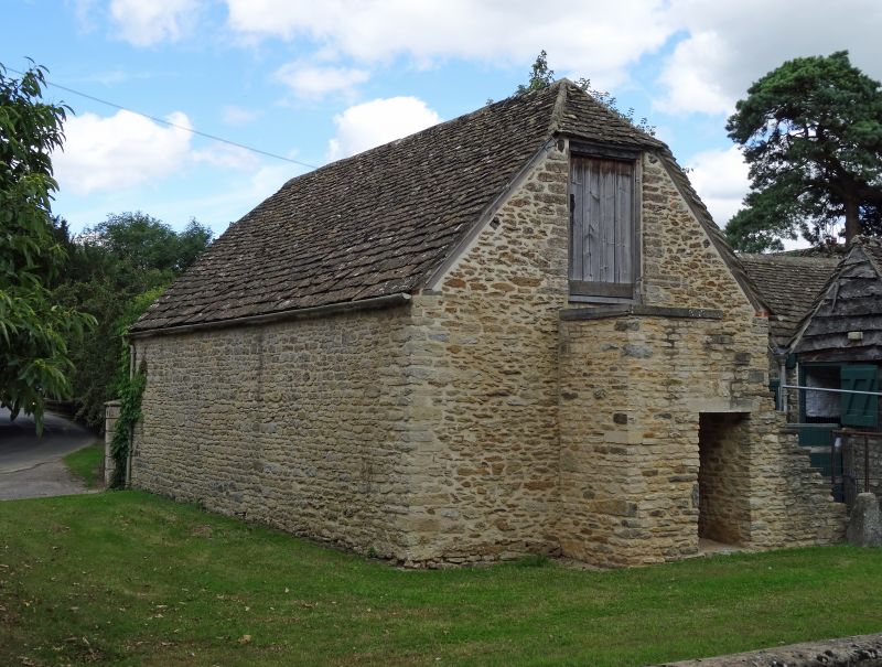
3/219 Stable at Brook Farm
GV II
Stable, later C18, rubble stone with half-hipped stone slate roof
and three east side stable doors. Prominently placed on roadside.
Included for group value.
Listing NGR: ST9655183101
External links are from the relevant listing authority and, where applicable, Wikidata. Wikidata IDs may be related buildings as well as this specific building. If you want to add or update a link, you will need to do so by editing the Wikidata entry.


Other nearby listed buildings
