Approximate Location Map
Large Map »
Latitude: 51.5056 / 51°30'20"N
Longitude: -2.0833 / 2°4'59"W
OS Eastings: 394315
OS Northings: 178519
OS Grid: ST943785
Mapcode National: GBR 2RZ.G47
Mapcode Global: VH965.VF05
Plus Code: 9C3VGW48+6M
Entry Name: Barn at Arms Farm to South
Listing Date: 20 December 1960
Grade: II
Source: Historic England
Source ID: 1363787
English Heritage Legacy ID: 316113
ID on this website: 101363787
Location: Sutton Benger, Wiltshire, SN15
County: Wiltshire
Civil Parish: Sutton Benger
Built-Up Area: Sutton Benger
Traditional County: Wiltshire
Lieutenancy Area (Ceremonial County): Wiltshire
Church of England Parish: Sutton Benger
Church of England Diocese: Bristol
Tagged with: Barn
SUTTON BENGER HIGH STREET
ST 9478 (south side)
12/285 Barn at Arms Farm to
south
20.12.60
GV II
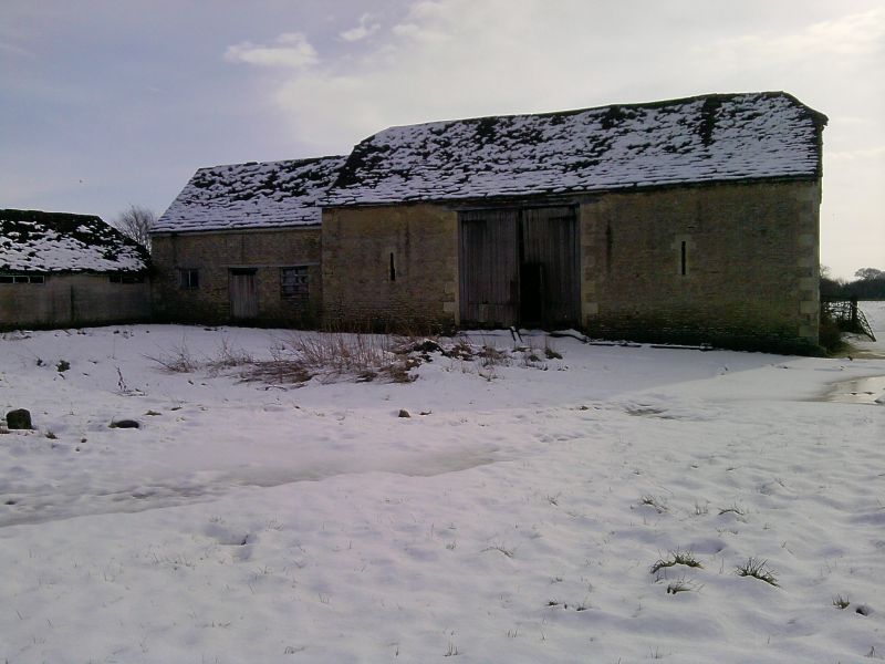
Barn, late C18, rubble stone with stone slate half-hipped roof,
south side hipped projecting cart-entry and plain north side entry
with timber lintel. Loading door in east end wall. Attached to
east, stable range with stone slate roof, door and window each
side.
Listing NGR: ST9431578519
External links are from the relevant listing authority and, where applicable, Wikidata. Wikidata IDs may be related buildings as well as this specific building. If you want to add or update a link, you will need to do so by editing the Wikidata entry.


Other nearby listed buildings
