Latitude: 51.1698 / 51°10'11"N
Longitude: -2.1212 / 2°7'16"W
OS Eastings: 391619
OS Northings: 141185
OS Grid: ST916411
Mapcode National: GBR 1VN.QHD
Mapcode Global: VH97Q.5VYK
Plus Code: 9C3V5V9H+WG
Entry Name: 175
Listing Date: 11 September 1968
Last Amended: 1 July 1986
Grade: II
Source: Historic England
Source ID: 1364354
English Heritage Legacy ID: 313324
ID on this website: 101364354
Location: Tytherington, Wiltshire, BA12
County: Wiltshire
Civil Parish: Heytesbury
Traditional County: Wiltshire
Lieutenancy Area (Ceremonial County): Wiltshire
Church of England Parish: Heytesbury with Tytherington and Knook St Peter and St Paul
Church of England Diocese: Salisbury
Tagged with: Building
HEYTESBURY TYTHERINGTON VILLAGE ST 94 SW (west side) 4/103 No. 175, (formerly listed as Chapel House No. 175) 11.9.68
GV II
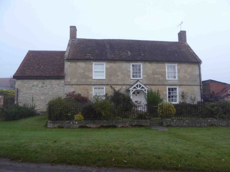
Farmhouse. Late C18. Limestone ashlar front, rubble stone returns, tiled roof with gable end brick stacks. 'L'-plan. Two storey, 3-windowed; sashes. Central 6-panelled door with fanlight and C19 gabled timber porch, either side is 12-pane flush sash in moulded architrave. Moulded string course to first floor; three 12-pane sashes. Moulded stone eaves cornice. Right return has 1- light casement to first floor and attic, coped verge to roof. Left return has C20 casement to first floor, attached single storey rubble stone outhouse with half-hipped tiled roof. Rear has integral outshut to left and C19 two storey extension with 2-light casements to right. Interior has 6-panelled doors, window shutters, entrance hall with round-arched openings. Attached to front are good spearhead iron railings on rendered dwarf walls with small urn finials to iron posts and single central gate.
Listing NGR: ST9161941185
External links are from the relevant listing authority and, where applicable, Wikidata. Wikidata IDs may be related buildings as well as this specific building. If you want to add or update a link, you will need to do so by editing the Wikidata entry.


Other nearby listed buildings