Latitude: 51.3465 / 51°20'47"N
Longitude: -1.8004 / 1°48'1"W
OS Eastings: 413994
OS Northings: 160841
OS Grid: SU139608
Mapcode National: GBR 4XY.FMD
Mapcode Global: VHB4K.RF14
Plus Code: 9C3W85WX+HR
Entry Name: Manor Farmhouse
Listing Date: 27 May 1964
Grade: II
Source: Historic England
Source ID: 1364665
English Heritage Legacy ID: 311780
ID on this website: 101364665
Location: Wilcot, Wiltshire, SN9
County: Wiltshire
Civil Parish: Wilcot
Traditional County: Wiltshire
Lieutenancy Area (Ceremonial County): Wiltshire
Tagged with: Farmhouse
WILCOT CHURCH END SU 16 SW (north-west side) 5/145 Manor Farmhouse 27.5.64
GV II
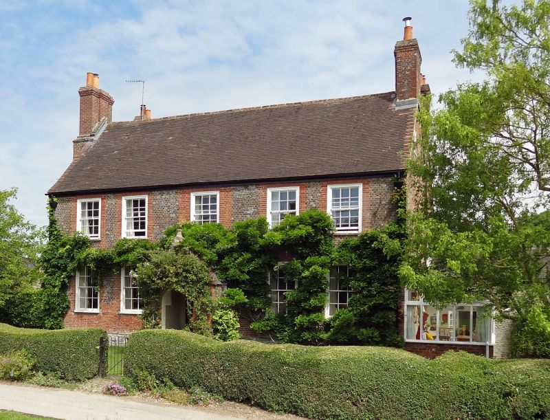
Farmhouse. Mid-late C18. Sarsen plinth with moulded top,and blue vitrified brick with red brick quoins and vertical dressings to windows. Tiled roof. Two storeys and attics, five bays. Double range. Central open gabled brick porch of C19. Six-panelled door above 3 steps. Twelve-pane sashes with gauged brick lintels, the centre bricks forming flush stepped key. Gable stacks, external to left gable. Parallel rear range also with gable stack. To rear, tall upper floor windows and glazed open verandah to ground floor. Interior not seen.
Listing NGR: SU1399460841
External links are from the relevant listing authority and, where applicable, Wikidata. Wikidata IDs may be related buildings as well as this specific building. If you want to add or update a link, you will need to do so by editing the Wikidata entry.


Other nearby listed buildings