Latitude: 52.2822 / 52°16'55"N
Longitude: -1.5838 / 1°35'1"W
OS Eastings: 428486
OS Northings: 264972
OS Grid: SP284649
Mapcode National: GBR 5M4.VT6
Mapcode Global: VHBXH.HWJW
Plus Code: 9C4W7CJ8+VF
Entry Name: 4 6, Gerrard Street
Listing Date: 19 March 1973
Grade: II
Source: Historic England
Source ID: 1364822
English Heritage Legacy ID: 307458
ID on this website: 101364822
Location: Warwick, Warwickshire, CV34
County: Warwickshire
District: Warwick
Civil Parish: Warwick
Built-Up Area: Warwick
Traditional County: Warwickshire
Lieutenancy Area (Ceremonial County): Warwickshire
Church of England Parish: Warwick St Nicholas
Church of England Diocese: Coventry
Tagged with: Building
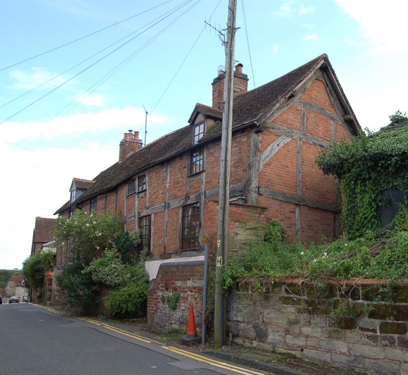
1.
1781 GERRARD STREET
(West Side)
Nos 4 and 6
SP 2864 NW 1/51
II
2.
First half of C16. Range of 2 storey dwellings standing above the street
on a tall stone plinth. Fairly heavy rectangular timber framework with
nogging of early red bricks. Modern wooden casements. 2 small dormer
gabled casements flush with front wall in roof of old tiles.
Listing NGR: SP2848664971
External links are from the relevant listing authority and, where applicable, Wikidata. Wikidata IDs may be related buildings as well as this specific building. If you want to add or update a link, you will need to do so by editing the Wikidata entry.


Other nearby listed buildings