Approximate Location Map
Large Map »
Latitude: 52.349 / 52°20'56"N
Longitude: -1.5889 / 1°35'19"W
OS Eastings: 428102
OS Northings: 272410
OS Grid: SP281724
Mapcode National: GBR 5LC.M3Z
Mapcode Global: VHBX9.D7W1
Plus Code: 9C4W8CX6+JF
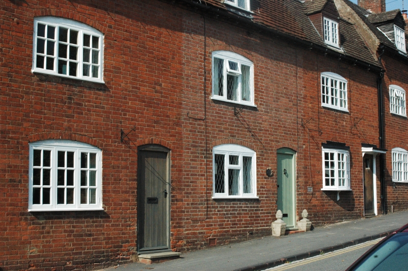
Entry Name: 16-20, Castle Hill
Listing Date: 10 November 1971
Grade: II
Source: Historic England
Source ID: 1364879
English Heritage Legacy ID: 307755
ID on this website: 101364879
Location: Castle Green, Warwick, Warwickshire, CV8
County: Warwickshire
District: Warwick
Civil Parish: Kenilworth
Built-Up Area: Kenilworth
Traditional County: Warwickshire
Lieutenancy Area (Ceremonial County): Warwickshire
Church of England Parish: Kenilworth St Nicholas
Church of England Diocese: Coventry
Tagged with: Building
CASTLE HILL
1.
1270
(North Side)
Nos 16 to 20 (even)
SP 2872 SW 5/89
II GV
2.
C18 front. Red brick, old tile.roof. 2 storeys and attic. Some windows
retain glazing bars.
All the listed buildings in Castle Hill (North Side) form a group.
Listing NGR: SP2810272410
External links are from the relevant listing authority and, where applicable, Wikidata. Wikidata IDs may be related buildings as well as this specific building. If you want to add or update a link, you will need to do so by editing the Wikidata entry.


Other nearby listed buildings
