Latitude: 52.2772 / 52°16'37"N
Longitude: -1.5935 / 1°35'36"W
OS Eastings: 427833
OS Northings: 264418
OS Grid: SP278644
Mapcode National: GBR 5M9.CXL
Mapcode Global: VHBXP.B1G3
Plus Code: 9C4W7CG4+VJ
Entry Name: The Vine Inn
Listing Date: 19 March 1973
Grade: II
Source: Historic England
Source ID: 1364883
English Heritage Legacy ID: 307672
ID on this website: 101364883
Location: Warwick, Warwickshire, CV34
County: Warwickshire
District: Warwick
Civil Parish: Warwick
Built-Up Area: Warwick
Traditional County: Warwickshire
Lieutenancy Area (Ceremonial County): Warwickshire
Church of England Parish: Warwick St Paul
Church of England Diocese: Coventry
Tagged with: Inn
1.
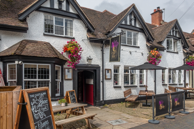
1781 WEST STREET
(North West Side)
Nos 86 and 88
(The Vine Inn)
SP 2764 8/518
II GV
2.
Restored front to early building. Machine tiles, pebble dash. Lattice
casements and canted sash bay on left. 2 storeys, 3 gables with modern
timber framework.
All the listed buildings on the north-west side from Nos 78 to 98
form a group
Listing NGR: SP2783364418
External links are from the relevant listing authority and, where applicable, Wikidata. Wikidata IDs may be related buildings as well as this specific building. If you want to add or update a link, you will need to do so by editing the Wikidata entry.


Other nearby listed buildings