Approximate Location Map
Large Map »
Latitude: 52.351 / 52°21'3"N
Longitude: -1.5792 / 1°34'45"W
OS Eastings: 428759
OS Northings: 272628
OS Grid: SP287726
Mapcode National: GBR 5LC.PJG
Mapcode Global: VHBX9.L50L
Plus Code: 9C4W9C2C+98
Entry Name: 23 and 25, New Street
Listing Date: 10 November 1971
Grade: II
Source: Historic England
Source ID: 1364893
English Heritage Legacy ID: 307824
ID on this website: 101364893
Location: Ladyes Hills, Warwick, Warwickshire, CV8
County: Warwickshire
District: Warwick
Civil Parish: Kenilworth
Built-Up Area: Kenilworth
Traditional County: Warwickshire
Lieutenancy Area (Ceremonial County): Warwickshire
Church of England Parish: Kenilworth St Nicholas
Church of England Diocese: Coventry
Tagged with: Building
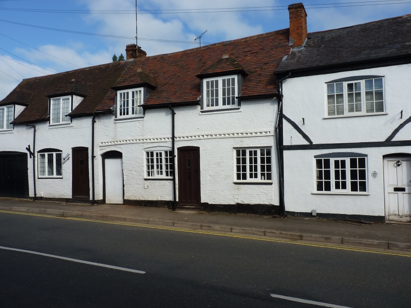
NEW STREET
1.
1270
(North Side)
Nos 23 and 25
SP 2872 NE 8/132
II GV
2.
C17 or earlier, altered. Whitewashed brick, tiles. One storey and attics,
3 casements, 4 hipped casement dormers. 1st floor band to No 25.
Nos 23 and 25 form a group.
Listing NGR: SP2875972628
External links are from the relevant listing authority and, where applicable, Wikidata. Wikidata IDs may be related buildings as well as this specific building. If you want to add or update a link, you will need to do so by editing the Wikidata entry.


Other nearby listed buildings
