Latitude: 52.349 / 52°20'56"N
Longitude: -1.5937 / 1°35'37"W
OS Eastings: 427772
OS Northings: 272401
OS Grid: SP277724
Mapcode National: GBR 5LB.RW1
Mapcode Global: VHBX9.B7B3
Plus Code: 9C4W8CX4+HG
Entry Name: Purlieu Gate Cottage
Listing Date: 10 November 1971
Grade: II
Source: Historic England
Source ID: 1364896
English Heritage Legacy ID: 307836
ID on this website: 101364896
Location: Castle Green, Warwick, Warwickshire, CV8
County: Warwickshire
District: Warwick
Civil Parish: Kenilworth
Built-Up Area: Kenilworth
Traditional County: Warwickshire
Lieutenancy Area (Ceremonial County): Warwickshire
Church of England Parish: Kenilworth St Nicholas
Church of England Diocese: Coventry
Tagged with: Cottage Thatched cottage
SP 2772 SE 7/134
1270
PURLIEU LANE
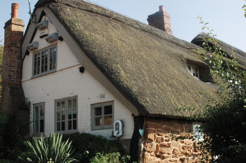
Purlieu Gate Cottage
II
C16 or C17. Timber frame and plaster, some sandstone rubble. One storey
and attic, modern casements with glazing bars. Thatched roof.
Listing NGR: SP2777272401
External links are from the relevant listing authority and, where applicable, Wikidata. Wikidata IDs may be related buildings as well as this specific building. If you want to add or update a link, you will need to do so by editing the Wikidata entry.


Other nearby listed buildings