Latitude: 52.4969 / 52°29'48"N
Longitude: -1.705 / 1°42'17"W
OS Eastings: 420124
OS Northings: 288812
OS Grid: SP201888
Mapcode National: GBR 4H4.FRB
Mapcode Global: VHBWG.DHHR
Plus Code: 9C4WF7WW+P2
Entry Name: 137 and 139, High Street
Listing Date: 26 January 1989
Grade: II
Source: Historic England
Source ID: 1365205
English Heritage Legacy ID: 309342
ID on this website: 101365205
Location: Coleshill, North Warwickshire, B46
County: Warwickshire
District: North Warwickshire
Civil Parish: Coleshill
Built-Up Area: Coleshill
Traditional County: Warwickshire
Lieutenancy Area (Ceremonial County): Warwickshire
Church of England Parish: Coleshill
Church of England Diocese: Birmingham
Tagged with: Building
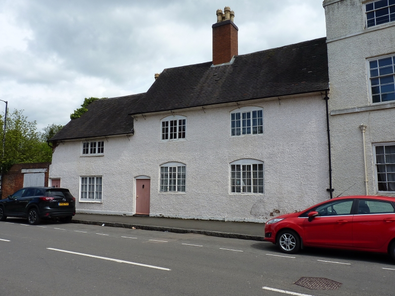
COLESHILL HIGH STREET
SP2088-2188 (East side)
11/28 No.137/139
GV II
House, formerly 2 cottages. Probably C17. Roughcast timber-framing and brick;
plain tile roof; brick ridge stacks. 2-storey, 2-bay main block to the right
with segmental-headed glazing bar casements and a segmental-headed plank door to
the left. Slightly lower 2-storey single-bay wing to the left with
straight-headed casements and left hand plank door. Partially exposed
collar-and-tie-beam roof trusses to the left hand gables. Interior not
inspected.
Listing NGR: SP2012488812
External links are from the relevant listing authority and, where applicable, Wikidata. Wikidata IDs may be related buildings as well as this specific building. If you want to add or update a link, you will need to do so by editing the Wikidata entry.


Other nearby listed buildings