Approximate Location Map
Large Map »
Latitude: 54.5807 / 54°34'50"N
Longitude: -1.8 / 1°47'59"W
OS Eastings: 413027
OS Northings: 520625
OS Grid: NZ130206
Mapcode National: GBR HHWG.3Q
Mapcode Global: WHC5L.B436
Plus Code: 9C6WH6J2+72
Entry Name: The Royal Oak
Listing Date: 14 September 1966
Grade: II
Source: Historic England
Source ID: 1365629
English Heritage Legacy ID: 111488
ID on this website: 101365629
Location: Staindrop, County Durham, DL2
County: County Durham
Civil Parish: Staindrop
Built-Up Area: Staindrop
Traditional County: Durham
Lieutenancy Area (Ceremonial County): County Durham
Church of England Parish: Staindrop
Church of England Diocese: Durham
Tagged with: Architectural structure
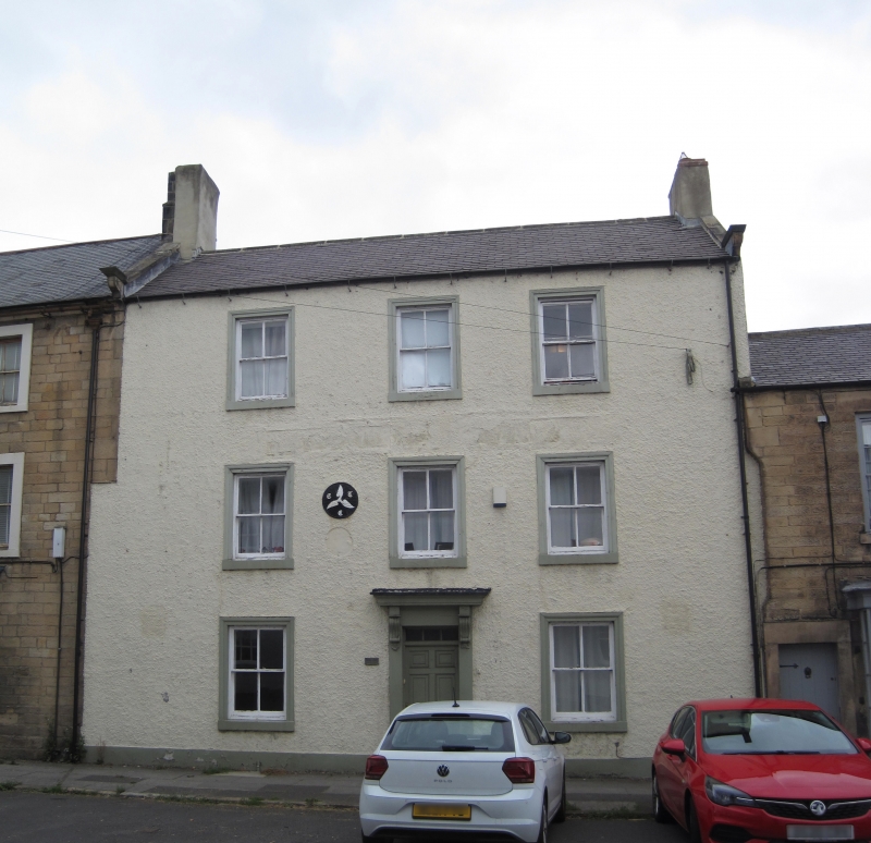
STAINDROP FRONT STREET
NZ 1320
(North side)
18/123 No. 41
14/9/66 (The Royal Oak)
GV II
Public house. Early C19. Painted rough render with ashlar and wood dressings;
Welsh slate roof with stone gable copings and rendered brick chimneys. 3
storeys, 3 bays. Central renewed boarded door and overlight in doorcase of
pilasters and scroll-bracketed cornice; wood architraves to late C19 sashes;
projecting stone sills. Welsh slate roof has end chimneys.
Listing NGR: NZ1302720625
External links are from the relevant listing authority and, where applicable, Wikidata. Wikidata IDs may be related buildings as well as this specific building. If you want to add or update a link, you will need to do so by editing the Wikidata entry.


Other nearby listed buildings
