Approximate Location Map
Large Map »
Latitude: 53.4033 / 53°24'11"N
Longitude: -2.9673 / 2°58'2"W
OS Eastings: 335787
OS Northings: 390039
OS Grid: SJ357900
Mapcode National: GBR 78Q.30
Mapcode Global: WH877.DQ7C
Plus Code: 9C5VC23M+83
Entry Name: 20-26, Oxford Street
Listing Date: 19 June 1985
Grade: II
Source: Historic England
Source ID: 1365830
English Heritage Legacy ID: 359212
ID on this website: 101365830
Location: Edge Hill, Liverpool, Merseyside, L7
County: Liverpool
Electoral Ward/Division: Central
Parish: Non Civil Parish
Built-Up Area: Liverpool
Traditional County: Lancashire
Lieutenancy Area (Ceremonial County): Merseyside
Church of England Parish: St Luke in the City Team
Church of England Diocese: Liverpool
Tagged with: Building
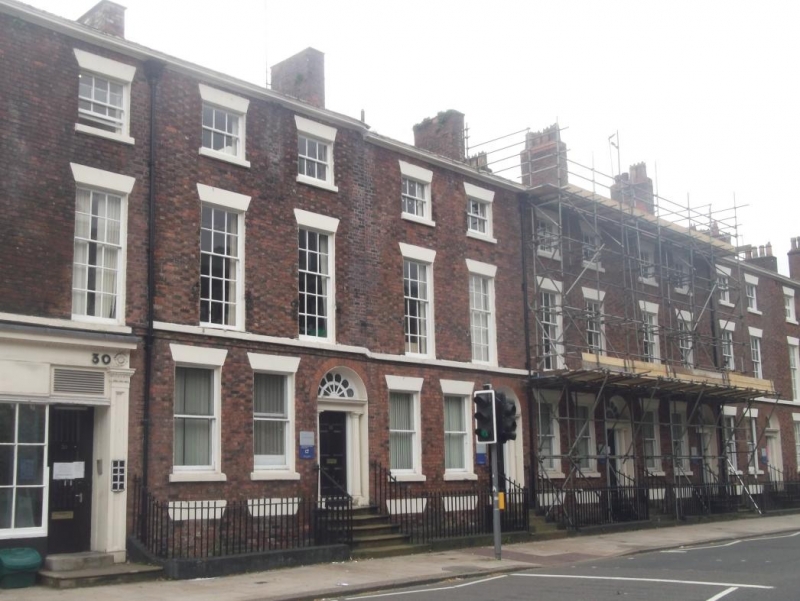
SJ 3589 NE OXFORD STREET
L7
57/871 Nos. 20 to 26
- (even)
G.V. II
Terrace of 4 houses. 1820s. Brick with stone dressings,
slate roof. 3 storeys with basement, 2 bays to each house.
1st floor sill band; top cornice. Windows have wedge lintels
and are sashed, those to 1st and 2nd floors with glazing
bars. Round-headed entrances have Doric doorcases with
fluted columns, complete fanlights and 6-panel doors. Plain
iron railings to areas and steps. No. 20 lacks fanlight
glazing bars. No. 22 has one iron balcony to 1st floor
window.
Listing NGR: SJ3580890035
External links are from the relevant listing authority and, where applicable, Wikidata. Wikidata IDs may be related buildings as well as this specific building. If you want to add or update a link, you will need to do so by editing the Wikidata entry.


Other nearby listed buildings
