Latitude: 53.3961 / 53°23'46"N
Longitude: -2.9693 / 2°58'9"W
OS Eastings: 335641
OS Northings: 389247
OS Grid: SJ356892
Mapcode National: GBR 77S.PK
Mapcode Global: WH877.CW8V
Plus Code: 9C5V92WJ+C7
Entry Name: 40-50, Percy Street including 53-57 Upper Parliament Street
Listing Date: 14 March 1975
Last Amended: 19 June 1985
Grade: II
Source: Historic England
Source ID: 1365836
English Heritage Legacy ID: 359239
ID on this website: 101365836
Location: Liverpool, Merseyside, L8
County: Liverpool
Electoral Ward/Division: Princes Park
Parish: Non Civil Parish
Built-Up Area: Liverpool
Traditional County: Lancashire
Lieutenancy Area (Ceremonial County): Merseyside
Church of England Parish: St Luke in the City Team
Church of England Diocese: Liverpool
Tagged with: Architectural structure
This list entry was subject to a Minor Amendment on 27/11/2018
SJ 3589 SE
60/895
PERCY STREET L8 (west side),
Nos. 40 to 50 (even)) including 53-57 (consec) Upper Parliament Street
(Formerly listed as Fir Grove, Flats 1 to 27 (consec), previously listed as Nos. 40 to 50 (even))
14.3.75
GV
II
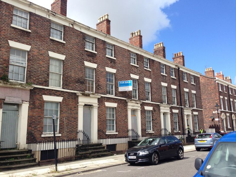
Terrace of eight houses, two on return to Upper Parliament Street, converted (2017) into houses and apartments. 1830s. Brick with stone dressings, slate roof. Three storeys with basement, two bays to each house. Basement lintel bands; 1st floor sill bands; top frieze and cornice. Windows have wedge lintels and are sashed with glazing bars. Entrances have angle pilasters and entablatures; most doors have 4 panels. Iron railings to areas and steps have decorative heads.
Ten bay return to Upper Parliament Street (Nos. 55 and 57 with three bays to No. 53). End bay has first floor canted bay window.
Listing NGR: SJ3564189247
External links are from the relevant listing authority and, where applicable, Wikidata. Wikidata IDs may be related buildings as well as this specific building. If you want to add or update a link, you will need to do so by editing the Wikidata entry.


Other nearby listed buildings