Latitude: 51.4283 / 51°25'41"N
Longitude: -1.8642 / 1°51'51"W
OS Eastings: 409534
OS Northings: 169926
OS Grid: SU095699
Mapcode National: GBR 3VK.HHD
Mapcode Global: VHB44.MCTF
Plus Code: 9C3WC4HP+88
Entry Name: Banning's Farmhouse
Listing Date: 22 August 1966
Grade: II
Source: Historic England
Source ID: 1365946
English Heritage Legacy ID: 311486
ID on this website: 101365946
Location: Avebury Trusloe, Wiltshire, SN8
County: Wiltshire
Civil Parish: Avebury
Traditional County: Wiltshire
Lieutenancy Area (Ceremonial County): Wiltshire
Tagged with: Farmhouse
AVEBURY BRAY STREET, Avebury Trusloe SU 06 NE 4/65 Banning's Farmhouse 22.8.66 II
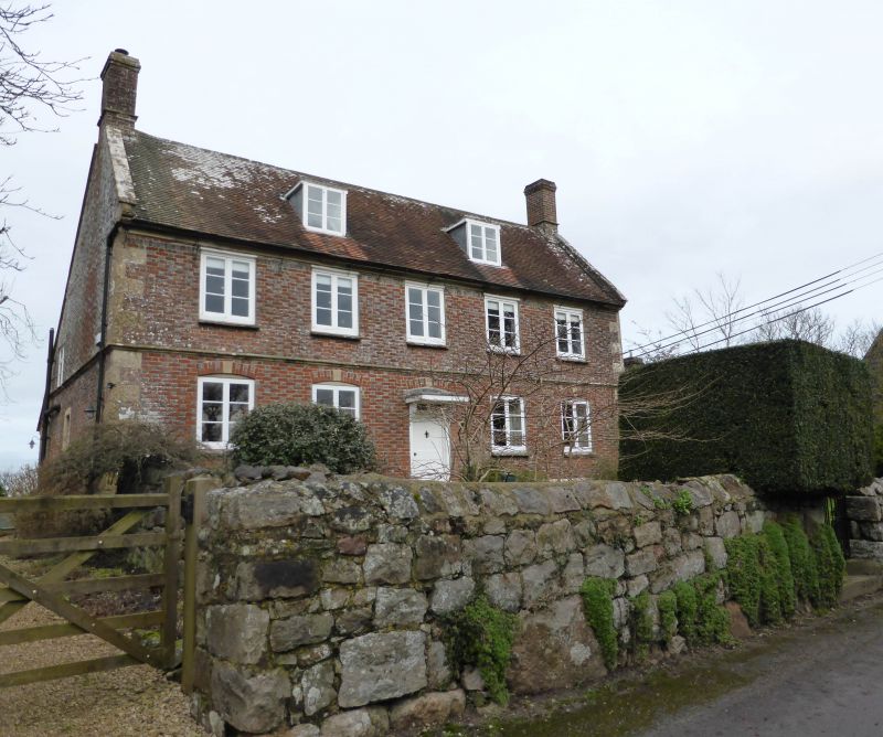
Farmhouse. Early C18. Diaper brick with stone dressings. Tiled roof. Two storeys, cellar and attics. Five bays. Central 4- panelled door with 2-light overlight and bracketed flat canopy. Moulded mid wall stone string and plinth and flush stone quoins. C19 timber casement windows in cambered brick openings and stone keys. Two flat roofed dormers. Gable stacks. Moulded stone windows to cellar under right bays. Roof extended over contemporary outshut to rear.
Listing NGR: SU0953469926
External links are from the relevant listing authority and, where applicable, Wikidata. Wikidata IDs may be related buildings as well as this specific building. If you want to add or update a link, you will need to do so by editing the Wikidata entry.


Other nearby listed buildings