Latitude: 51.2654 / 51°15'55"N
Longitude: 0.9618 / 0°57'42"E
OS Eastings: 606720
OS Northings: 155975
OS Grid: TR067559
Mapcode National: GBR SWS.PYQ
Mapcode Global: VHKK3.MG98
Plus Code: 9F327X86+5P
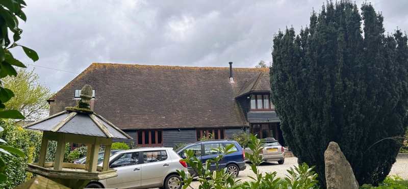
Entry Name: Barn, 20 Yards North of Upper Ensign House
Listing Date: 13 August 1984
Grade: II
Source: Historic England
Source ID: 1366083
English Heritage Legacy ID: 181473
ID on this website: 101366083
Location: Rhode Common, Ashford, Kent, CT4
County: Kent
District: Ashford
Town: Ashford
Civil Parish: Chilham
Traditional County: Kent
Lieutenancy Area (Ceremonial County): Kent
Tagged with: Barn
TR 05 NE CHILHAM SELLING ROAD
(east side), Old Wives Lees
1/1 Barn, 20 yards north
of Upper Ensign House
GV II
Barn. C17. Timber frame on flint and brick plinth and clad in
weather board with corrugated asbestos, hipped roof. Hipped
stray to right. Interior: 5 aisled bays, with passing shores, and
arched bracing to cambered tie-beam. C20 purlin roof.
Listing NGR: TR0673155945
External links are from the relevant listing authority and, where applicable, Wikidata. Wikidata IDs may be related buildings as well as this specific building. If you want to add or update a link, you will need to do so by editing the Wikidata entry.


Other nearby listed buildings