Approximate Location Map
Large Map »
Latitude: 51.3345 / 51°20'4"N
Longitude: 1.4239 / 1°25'25"E
OS Eastings: 638592
OS Northings: 165061
OS Grid: TR385650
Mapcode National: GBR X0M.6TN
Mapcode Global: VHMCW.MQM9
Plus Code: 9F338CMF+RH
Entry Name: No 52 and Railed Area
Listing Date: 13 August 1968
Grade: II
Source: Historic England
Source ID: 1366653
English Heritage Legacy ID: 171960
ID on this website: 101366653
Location: Ramsgate, Thanet, Kent, CT11
County: Kent
District: Thanet
Civil Parish: Ramsgate
Built-Up Area: Ramsgate
Traditional County: Kent
Lieutenancy Area (Ceremonial County): Kent
Tagged with: Building
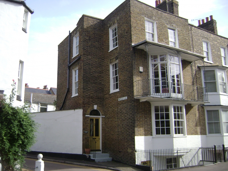
RAMSGATE THE PLAINS OF
TR 3865 SE
WATERLOO
(east side)
10/331 No. 52 and railed
area
13.8.68
GV II
Terrace house. 1820's. Stock brick and slate roof. Three storeys and
basement with parapet and stack to right. Two glazing bars on 2nd floor,
and 2 storey canted bay below with margin light French windows on 1st
floor in tented verandah with scalloped iron pier brackets. Glazing bar
sashes on ground floor and basement. Half-glazed door in recessed wing
to left return, with fluted keyed semi-circular surround. Simple rails to
steps; hooped rails to area.
Listing NGR: TR3859265061
External links are from the relevant listing authority and, where applicable, Wikidata. Wikidata IDs may be related buildings as well as this specific building. If you want to add or update a link, you will need to do so by editing the Wikidata entry.


Other nearby listed buildings
