Approximate Location Map
Large Map »
Latitude: 51.4435 / 51°26'36"N
Longitude: 0.3692 / 0°22'9"E
OS Eastings: 564749
OS Northings: 174276
OS Grid: TQ647742
Mapcode National: GBR NMK.J4P
Mapcode Global: VHJLC.CZ28
Plus Code: 9F32C9V9+CM
Entry Name: 56, High Street
Listing Date: 3 July 1975
Grade: II
Source: Historic England
Source ID: 1367124
English Heritage Legacy ID: 356361
ID on this website: 101367124
Location: Gravesend, Gravesham, Kent, DA11
County: Kent
District: Gravesham
Electoral Ward/Division: Pelham
Parish: Non Civil Parish
Built-Up Area: Gravesend
Traditional County: Kent
Lieutenancy Area (Ceremonial County): Kent
Church of England Parish: Gravesend St George
Church of England Diocese: Rochester
Tagged with: Building
1.
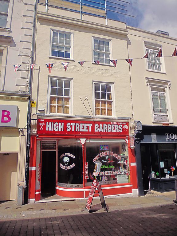
5277 HIGH STREET
(West Side)
No 56
TQ 6474 SE 1/98
II GV
2.
C18. 3 storeys painted brick. Parapet and dropped moulded eaves cornice. 2
sashes with glazing bars intact. Modern shopfront. This was formerly part of
the Albion Public House.
Nos 55 to 59 (consec) and 55A form a group.
Listing NGR: TQ6473774278
External links are from the relevant listing authority and, where applicable, Wikidata. Wikidata IDs may be related buildings as well as this specific building. If you want to add or update a link, you will need to do so by editing the Wikidata entry.


Other nearby listed buildings
