Approximate Location Map
Large Map »
Latitude: 52.8567 / 52°51'23"N
Longitude: -3.0577 / 3°3'27"W
OS Eastings: 328875
OS Northings: 329320
OS Grid: SJ288293
Mapcode National: GBR 73.S1RH
Mapcode Global: WH89X.0G6C
Plus Code: 9C4RVW4R+MW
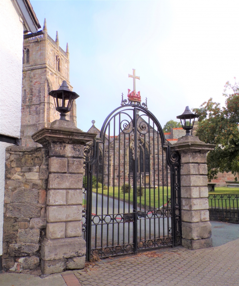
Entry Name: Gate Piers Approximately 30 Metres South of St Oswald
Listing Date: 15 May 1986
Grade: II
Source: Historic England
Source ID: 1367310
English Heritage Legacy ID: 255520
ID on this website: 101367310
Location: Croesoswallt, Shropshire, SY11
County: Shropshire
Civil Parish: Oswestry
Built-Up Area: Croesowallt
Traditional County: Shropshire
Lieutenancy Area (Ceremonial County): Shropshire
Church of England Parish: Oswestry St Oswald King and Martyr
Church of England Diocese: Lichfield
Tagged with: Gatepost
SJ 2829 SE OSWESTRY c'.P. CHURCH STREET (west side)
15/50 Gate piers approx.
30m south of Church
of St. Oswald
GV II
Gate piers. Probably late C18. Rusticated sandstone ashlar. Square
section. Moulded plinths and capping. C20 wrought-iron gates and lamps
surmounting piers.
Listing NGR: SJ2887429320
External links are from the relevant listing authority and, where applicable, Wikidata. Wikidata IDs may be related buildings as well as this specific building. If you want to add or update a link, you will need to do so by editing the Wikidata entry.


Other nearby listed buildings
