Latitude: 52.8903 / 52°53'25"N
Longitude: -2.9908 / 2°59'26"W
OS Eastings: 333433
OS Northings: 332996
OS Grid: SJ334329
Mapcode National: GBR 76.PS11
Mapcode Global: WH89R.1M23
Plus Code: 9C4VV2R5+4M
Entry Name: Hindford Grange
Listing Date: 2 September 1987
Grade: II
Source: Historic England
Source ID: 1367398
English Heritage Legacy ID: 255845
ID on this website: 101367398
Location: Hindford, Shropshire, SY11
County: Shropshire
Civil Parish: Whittington
Traditional County: Shropshire
Lieutenancy Area (Ceremonial County): Shropshire
Church of England Parish: Whittington St John the Baptist
Church of England Diocese: Lichfield
Tagged with: Building
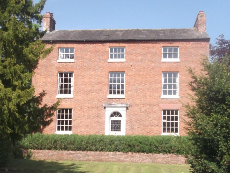
WHITTINGTON C.P. HINDFORD SJ 33 SW 5/129 Hindford Grange II Farmhouse. Early C19 with later additions and alterations. Red brick; graded slate roof with integral end stacks. Rectangular main block with wide gabled range at right-angles to rear on right and contemporary 2-storey lean-to to rear on left. 3 storeys with dentilled eaves cornice; 3-window front, glazing bar sashes (16-paned to ground floor and centre on first floor) with gauged heads; reduced proportions to second floor. Central entrance; plain pilastered doorcase with panelled reveals and soffit; recessed half-glazed door with late C19 or early C20 stained glass to top and early C19 fanlight.
Listing NGR: SJ3343332996
External links are from the relevant listing authority and, where applicable, Wikidata. Wikidata IDs may be related buildings as well as this specific building. If you want to add or update a link, you will need to do so by editing the Wikidata entry.


Other nearby listed buildings