Approximate Location Map
Large Map »
Latitude: 52.5368 / 52°32'12"N
Longitude: -2.4208 / 2°25'14"W
OS Eastings: 371557
OS Northings: 293300
OS Grid: SO715933
Mapcode National: GBR BZ.F6RH
Mapcode Global: VH90Z.0H3M
Plus Code: 9C4VGHPH+PM
Entry Name: 5 and 6, High Street
Listing Date: 18 July 1949
Grade: II
Source: Historic England
Source ID: 1367464
English Heritage Legacy ID: 254422
ID on this website: 101367464
Location: High Town, Shropshire, WV16
County: Shropshire
Civil Parish: Bridgnorth
Built-Up Area: Bridgnorth
Traditional County: Shropshire
Lieutenancy Area (Ceremonial County): Shropshire
Church of England Parish: Bridgnorth
Church of England Diocese: Hereford
Tagged with: Building
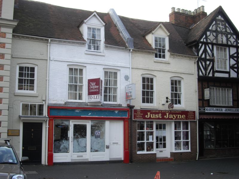
1.
1954 BRIDGNORTH
HIGH STREET
(West Side)
Nos 5 and 6
SO 79 SW 2/85 18.7.49.
II GV
2.
C18. Painted brick; 2 storeys; 4 sash windows. 1 door now remains in
moulded recess with moulded wood canopy on wrought iron brackets; brick
eaves; 2 gabled attics breaking above eaves; tiles. Modern shop front
to No 5.
Nos 3 to 7 (consec) form a group
Listing NGR: SO7155793300
External links are from the relevant listing authority and, where applicable, Wikidata. Wikidata IDs may be related buildings as well as this specific building. If you want to add or update a link, you will need to do so by editing the Wikidata entry.


Other nearby listed buildings
