Latitude: 52.5378 / 52°32'16"N
Longitude: -2.3064 / 2°18'22"W
OS Eastings: 379315
OS Northings: 293374
OS Grid: SO793933
Mapcode National: GBR 08F.ZMX
Mapcode Global: VH910.ZG2V
Plus Code: 9C4VGMQV+4C
Entry Name: King's Arms Inn
Listing Date: 1 February 1974
Grade: II
Source: Historic England
Source ID: 1367509
English Heritage Legacy ID: 254659
ID on this website: 101367509
Location: Claverley, Shropshire, WV5
County: Shropshire
Civil Parish: Claverley
Built-Up Area: Claverley
Traditional County: Shropshire
Lieutenancy Area (Ceremonial County): Shropshire
Church of England Parish: Claverley
Church of England Diocese: Hereford
Tagged with: Inn
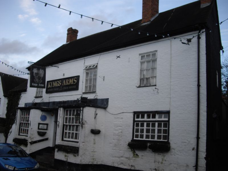
1.
1954 CLAVERLEY CLAVERLEY
BULL RING
King's Arms Inn
SO 79 SE 23/9
II
2.
C18 and later. Painted brick; 2 storeys; 3 casement windows; modern doorway
and steps up between 2 canted bays on ground floor, each with a sash window;
plain eaves and gabled ends; brick stacks; tiles. Lower gabled wing on
left-hand side.
Listing NGR: SO7931593374
External links are from the relevant listing authority and, where applicable, Wikidata. Wikidata IDs may be related buildings as well as this specific building. If you want to add or update a link, you will need to do so by editing the Wikidata entry.


Other nearby listed buildings