Approximate Location Map
Large Map »
Latitude: 52.4626 / 52°27'45"N
Longitude: -2.5641 / 2°33'50"W
OS Eastings: 361772
OS Northings: 285113
OS Grid: SO617851
Mapcode National: GBR BS.KTQZ
Mapcode Global: VH83T.HCVH
Plus Code: 9C4VFC7P+29
Entry Name: The Boyne Arms Inn
Listing Date: 9 March 1970
Last Amended: 1 February 1974
Grade: II
Source: Historic England
Source ID: 1367519
English Heritage Legacy ID: 254604
ID on this website: 101367519
Location: Burwarton, Shropshire, WV16
County: Shropshire
Civil Parish: Burwarton
Traditional County: Shropshire
Lieutenancy Area (Ceremonial County): Shropshire
Church of England Parish: Cleobury North
Church of England Diocese: Hereford
Tagged with: Inn
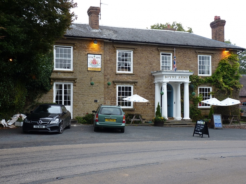
1.
1954 BURWARTON BURWARTON
The Boyne Arms Inn
SO 68 NW 26/8
II
2.
Early C19. Stone with hipped slate roof and brick stacks; 2 storeys;
* sash windows with bracketed hoods; Doric pillared porch and plain doorcase
wiith semi-circular fanlight; bold eaves.
Listing NGR: SO6177285113
External links are from the relevant listing authority and, where applicable, Wikidata. Wikidata IDs may be related buildings as well as this specific building. If you want to add or update a link, you will need to do so by editing the Wikidata entry.


Other nearby listed buildings
