Latitude: 52.5588 / 52°33'31"N
Longitude: -2.3578 / 2°21'28"W
OS Eastings: 375839
OS Northings: 295720
OS Grid: SO758957
Mapcode National: GBR 085.JPT
Mapcode Global: WH9DQ.RYF7
Plus Code: 9C4VHJ5R+GV
Entry Name: 9, Main Street
Listing Date: 1 February 1974
Grade: II
Source: Historic England
Source ID: 1367596
English Heritage Legacy ID: 255025
Also known as: 9 Worfield
ID on this website: 101367596
This list entry was subject to a Minor Amendment on 31/10/2017
SO 79 NE
16/19
WORFIELD
MAIN STREET
No 9
(Formerly listed as No 9, Worfield)
GV
II
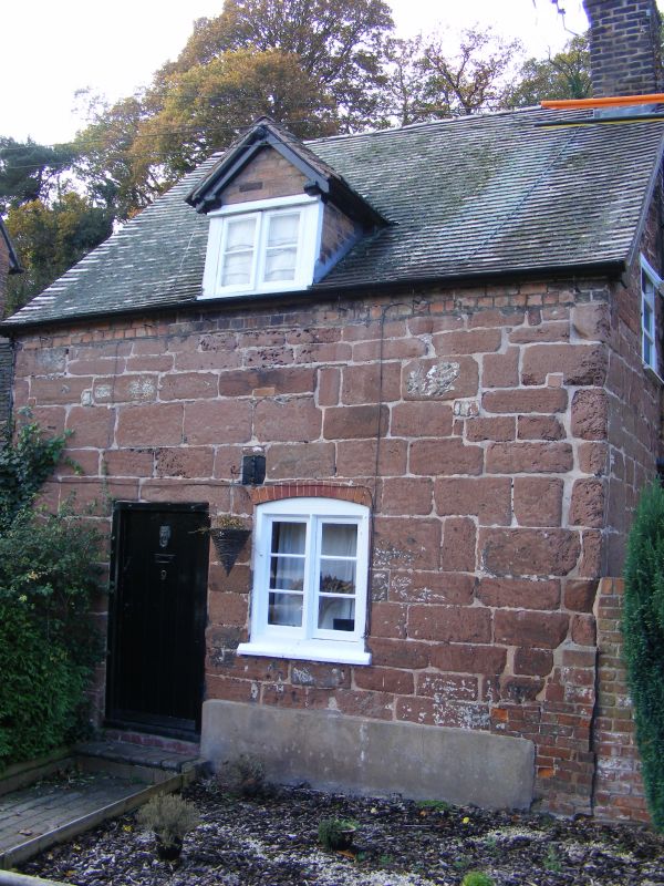
Probably C18. Coursed sandstone rubble; One storey plus attic; one later casement window; simple doorway with plank door; plain eaves; tiles. Single storeyed brick wing on left-hand side. Included for group value.
St Peter's Church, The Post Office, Shop Cottage, Nos 4 to 7 (consec) Crow Cottage, Nos 9 to 12 (consec) and The Club House form a group
Listing NGR: SO7583995720
External links are from the relevant listing authority and, where applicable, Wikidata. Wikidata IDs may be related buildings as well as this specific building. If you want to add or update a link, you will need to do so by editing the Wikidata entry.


Other nearby listed buildings