Approximate Location Map
Large Map »
Latitude: 52.7056 / 52°42'20"N
Longitude: -2.3592 / 2°21'33"W
OS Eastings: 375825
OS Northings: 312048
OS Grid: SJ758120
Mapcode National: GBR 06F.BCY
Mapcode Global: WH9D4.Q8R6
Plus Code: 9C4VPJ4R+68
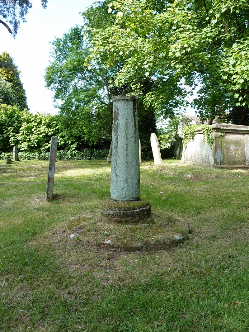
Entry Name: Cross base and sundial approximately 21 metres to north of chancel of Church of St. Mary
Listing Date: 29 August 1984
Grade: II
Source: Historic England
Source ID: 1367629
English Heritage Legacy ID: 255199
ID on this website: 101367629
Location: St Mary's Church, Sheriffhales, Shropshire, TF11
County: Shropshire
Civil Parish: Sheriffhales
Built-Up Area: Sheriffhales
Traditional County: Staffordshire
Lieutenancy Area (Ceremonial County): Shropshire
Church of England Parish: Sheriffhales St Mary
Church of England Diocese: Lichfield
Tagged with: Monumental cross
SJ 71 SE
4/16
SHERIFFHALES CP
CHURCH LANE (west side)
Cross base and sundial approximately 21 metres to north of chancel of Church of St. Mary.
GV
II
Churchyard cross base and sundial. Medieval and C18. Ashlar. Octagonal step, moulded circular base and C18 tapered circular shaft with evidence of sundial.
Listing NGR: SJ7582512048
External links are from the relevant listing authority and, where applicable, Wikidata. Wikidata IDs may be related buildings as well as this specific building. If you want to add or update a link, you will need to do so by editing the Wikidata entry.


Other nearby listed buildings
