Latitude: 51.7185 / 51°43'6"N
Longitude: -1.5542 / 1°33'15"W
OS Eastings: 430892
OS Northings: 202296
OS Grid: SP308022
Mapcode National: GBR 5V4.9VD
Mapcode Global: VHC0F.02QD
Plus Code: 9C3WPC9W+C8
Entry Name: Cowsheds 10 Metres South of the Old Farmhouse
Listing Date: 4 May 1989
Grade: II
Source: Historic England
Source ID: 1367697
English Heritage Legacy ID: 253428
ID on this website: 101367697
Location: Weald, West Oxfordshire, OX18
County: Oxfordshire
District: West Oxfordshire
Civil Parish: Bampton
Traditional County: Oxfordshire
Lieutenancy Area (Ceremonial County): Oxfordshire
Church of England Parish: Bampton with Clanfield
Church of England Diocese: Oxford
Tagged with: Cowshed Thatched building
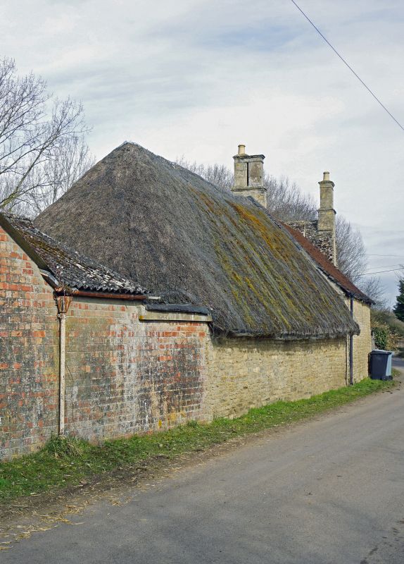
SP3002-3102 BAMPTON WEALD STREET (West side) Weald 14/118 Cowsheds 10m S of The Old Farmhouse
GV II Cowsheds. C18, part altered and raised C19-C20. Coursed rubble limestone. 2 bays at south end of range have hipped thatch roof, and are of one storey, each bay with stable door and unglazed window. Wide bay at north end is raised and roofed with C20 tiles, and has loft. Side to yard has 4-pane sash in altered opening with wooden lintel; gable end has stone steps up to loft door. Thatched part retains original roof structure with rough collar and tie-beam trusses and double purlins. Included for group value.
Listing NGR: SP3089202296
External links are from the relevant listing authority and, where applicable, Wikidata. Wikidata IDs may be related buildings as well as this specific building. If you want to add or update a link, you will need to do so by editing the Wikidata entry.


Other nearby listed buildings