Latitude: 51.8028 / 51°48'9"N
Longitude: -1.6383 / 1°38'17"W
OS Eastings: 425037
OS Northings: 211632
OS Grid: SP250116
Mapcode National: GBR 5SW.SS3
Mapcode Global: VHBZS.KY8C
Plus Code: 9C3WR936+4M
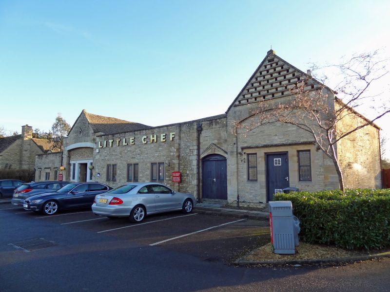
Entry Name: Bury Barn Inn with Attached Stables and Dovecote Wings
Listing Date: 1 March 1990
Grade: II
Source: Historic England
Source ID: 1367799
English Heritage Legacy ID: 254104
ID on this website: 101367799
Location: Burford, West Oxfordshire, OX18
County: Oxfordshire
District: West Oxfordshire
Civil Parish: Burford
Built-Up Area: Burford
Traditional County: Oxfordshire
Lieutenancy Area (Ceremonial County): Oxfordshire
Church of England Parish: Burford
Church of England Diocese: Oxford
Tagged with: Inn
BURFORD AND UPTON A40 AND SIGNET (South Side) SP2411-2511 Bury Barn Inn with 6/2 attached stables and Dovecote wings,
GV II
Barn, coach/cartshed and stable plus dovecote now inn. Possibly C18 referred to as site of manorial barns in the C16. Rubble with Cotswold stone roof, the barn has coped verges and ball finials. Long 8-bay barn with long projecting gabled entries; to North linking to 2-storey 3-window coach-house/stable with ashlar dressings painted at time of resurvey; this stable has loft entry over segment-headed part-blocked entrance; the corner of the coach-house has 2 dates: 1850 on keystone of adjacent doorway and 1859 in re-set cast iron rain-water head. Set-back cart-shed in coursed and dressed rubble to right, blocked segment-headed entry; pigeon-holes in entry. C20 inn extensions to left of midstrey. To rear: domestic windows 3:2 flanking the entry; 2 buttresses. Interior: simple collar and tie-beam roof. R & M Moody: The Story of Burford (1983).
Listing NGR: SP2503711632
External links are from the relevant listing authority and, where applicable, Wikidata. Wikidata IDs may be related buildings as well as this specific building. If you want to add or update a link, you will need to do so by editing the Wikidata entry.


Other nearby listed buildings