Approximate Location Map
Large Map »
Latitude: 51.6441 / 51°38'38"N
Longitude: -1.2717 / 1°16'18"W
OS Eastings: 450488
OS Northings: 194175
OS Grid: SU504941
Mapcode National: GBR 7YY.WVC
Mapcode Global: VHCY6.XY10
Plus Code: 9C3WJPVH+J8
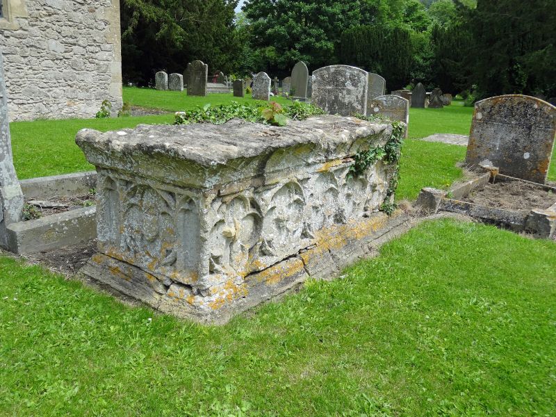
Entry Name: Chest Tomb Approximately 10 Metres South of Chancel of Church of All Saints
Listing Date: 19 February 1988
Grade: II*
Source: Historic England
Source ID: 1368103
English Heritage Legacy ID: 251407
ID on this website: 101368103
Location: All Saint's Church, Sutton Courtenay, Vale of White Horse, Oxfordshire, OX14
County: Oxfordshire
District: Vale of White Horse
Civil Parish: Sutton Courtenay
Built-Up Area: Sutton Courtenay
Traditional County: Berkshire
Lieutenancy Area (Ceremonial County): Oxfordshire
Church of England Parish: Sutton Courtenay
Church of England Diocese: Oxford
Tagged with: Chest tomb
SUTTON COURTENAY CHURCH STREET
SU5094 (East side)
7/91 Chest tomb approx. 10m S of
Chancel of Church of All
Saints
GV II*
Chest tomb. C15. Stone. 5 quatrefoil panels to each side. Single quatrefoil
flanked by lancet tracery to each end. Worn stone top slab.
Listing NGR: SU5048894175
External links are from the relevant listing authority and, where applicable, Wikidata. Wikidata IDs may be related buildings as well as this specific building. If you want to add or update a link, you will need to do so by editing the Wikidata entry.


Other nearby listed buildings
