Latitude: 51.5824 / 51°34'56"N
Longitude: -1.5572 / 1°33'25"W
OS Eastings: 430779
OS Northings: 187148
OS Grid: SU307871
Mapcode National: GBR 5WP.P46
Mapcode Global: VHC0Z.YHN9
Plus Code: 9C3WHCJV+W4
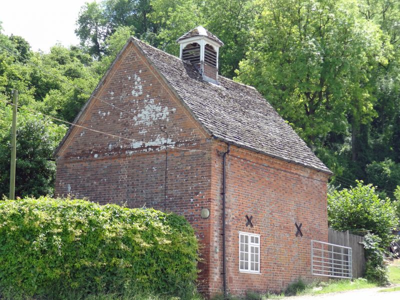
Entry Name: Britchcombe Farmhouse, Dovecote Approximately 20 Metres West
Listing Date: 11 December 1985
Grade: II
Source: Historic England
Source ID: 1368382
English Heritage Legacy ID: 250779
ID on this website: 101368382
Location: Vale of White Horse, Oxfordshire, SN7
County: Oxfordshire
District: Vale of White Horse
Civil Parish: Uffington
Traditional County: Berkshire
Lieutenancy Area (Ceremonial County): Oxfordshire
Church of England Parish: Uffington
Church of England Diocese: Oxford
Tagged with: Dovecote
UFFINGTON SU38NW 6/143 Britchcombe Farmhouse, dovecote approx 20 metres west
- II
Dovecote and granary. Late C18. Flemish bond brick with flared headers; stone slate roof. Originally 2 storeys. Front faces farmhouse: segmental arch over blocked central door, late C19 full dormer over. Timber lintel over plank door in right gable wall; timber lintel over 2-light C20 window in left gable wall. Banded eaves course, carried across gable ends. Timber glover to centre of ridge; gabled roof. Interior: floor has collapsed, but interior originally had granary raised above ground level, with dovecote in upper level; brick nesting boxes; 3-bay queen-strut roof, the trusses being closely set together to support the glover.
Listing NGR: SU3077987148
External links are from the relevant listing authority and, where applicable, Wikidata. Wikidata IDs may be related buildings as well as this specific building. If you want to add or update a link, you will need to do so by editing the Wikidata entry.


Other nearby listed buildings