Approximate Location Map
Large Map »
Latitude: 51.658 / 51°39'28"N
Longitude: -1.5811 / 1°34'51"W
OS Eastings: 429073
OS Northings: 195553
OS Grid: SU290955
Mapcode National: GBR 5VP.WMB
Mapcode Global: VHC0L.JLZB
Plus Code: 9C3WMC59+6H
Entry Name: Winlakes
Listing Date: 10 July 1986
Grade: II
Source: Historic England
Source ID: 1368499
English Heritage Legacy ID: 249410
ID on this website: 101368499
Location: Faringdon, Vale of White Horse, Oxfordshire, SN7
County: Oxfordshire
District: Vale of White Horse
Civil Parish: Great Faringdon
Built-Up Area: Faringdon
Traditional County: Berkshire
Lieutenancy Area (Ceremonial County): Oxfordshire
Church of England Parish: Faringdon
Church of England Diocese: Oxford
Tagged with: Building
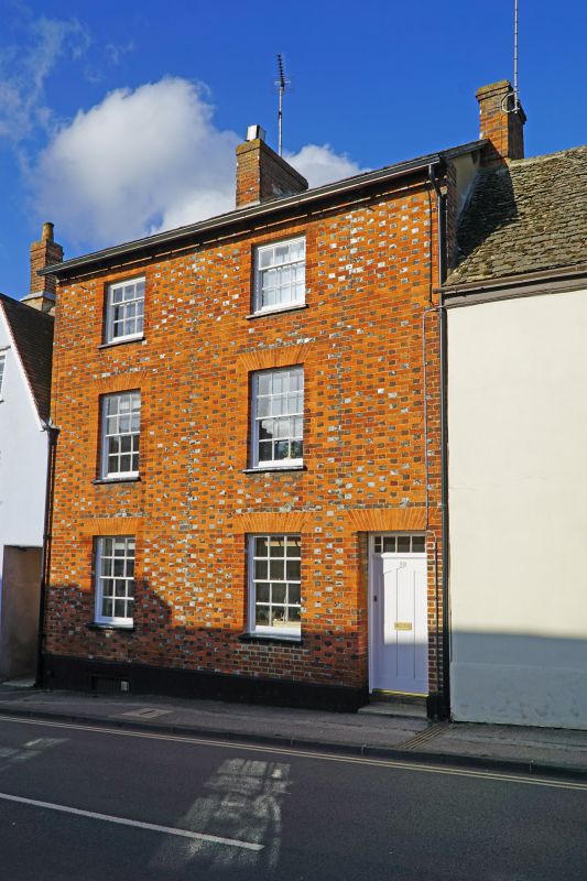
GREAT FARINGDON LONDON STREET
SU 2995 (north side)
3/87 No 39 (Winlakes)
-
GV II
Earlier C19 chequered brick house. 3-storey with low pitch slate eaves roof.
Brick ridge stack. 2-window range of glazing bar sashes with gauged brick flat
heads. Door set to east side with rectangular barred fanlight. Rubble stone
rear. Listed for group value.
Listing NGR: SU2907595556
External links are from the relevant listing authority and, where applicable, Wikidata. Wikidata IDs may be related buildings as well as this specific building. If you want to add or update a link, you will need to do so by editing the Wikidata entry.


Other nearby listed buildings
