Approximate Location Map
Large Map »
Latitude: 51.6981 / 51°41'53"N
Longitude: -1.18 / 1°10'47"W
OS Eastings: 456770
OS Northings: 200246
OS Grid: SP567002
Mapcode National: GBR 8ZT.GHY
Mapcode Global: VHCY2.HLK3
Plus Code: 9C3WMRXC+62
Entry Name: Church of St Lawrence Churchyard Cross Approximately 2 Metres to South
Listing Date: 19 August 1986
Grade: II
Source: Historic England
Source ID: 1368731
English Heritage Legacy ID: 248411
ID on this website: 101368731
Location: St Lawrence's Church, Baldon Row, South Oxfordshire, OX44
County: Oxfordshire
District: South Oxfordshire
Civil Parish: Toot Baldon
Traditional County: Oxfordshire
Lieutenancy Area (Ceremonial County): Oxfordshire
Church of England Parish: Marsh Baldon with Toot Baldon and Nuneham Courtenay
Church of England Diocese: Oxford
Tagged with: Churchyard cross
TOOT BALDON
SP5600
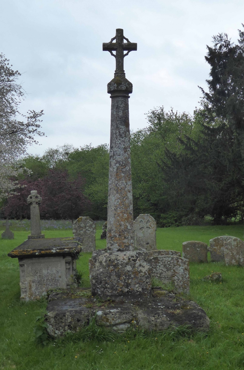
8/173 Church of St. Lawrence,
churchyard cross approx. 2m.
to S
GV II
Churchyard cross. C15, restored C19. Limestone. Octagonal tapering shaft has a
renewed cap and cross finial and rises from a chamfered square base with broach
stops standing on a wide plinth.
(Buildings of England: Oxfordshire, p.819).
Listing NGR: SP5677000246
External links are from the relevant listing authority and, where applicable, Wikidata. Wikidata IDs may be related buildings as well as this specific building. If you want to add or update a link, you will need to do so by editing the Wikidata entry.


Other nearby listed buildings
