Latitude: 51.6239 / 51°37'26"N
Longitude: -1.0903 / 1°5'25"W
OS Eastings: 463067
OS Northings: 192068
OS Grid: SU630920
Mapcode National: GBR B27.155
Mapcode Global: VHCYJ.1FXZ
Plus Code: 9C3WJWF5+HV
Entry Name: Fifield Farmhouse and Barns and Shelter Sheds and Stables
Listing Date: 18 July 1963
Last Amended: 28 November 1985
Grade: II
Source: Historic England
Source ID: 1369026
English Heritage Legacy ID: 247729
ID on this website: 101369026
Location: South Oxfordshire, OX10
County: Oxfordshire
District: South Oxfordshire
Civil Parish: Benson
Built-Up Area: Benson
Traditional County: Oxfordshire
Lieutenancy Area (Ceremonial County): Oxfordshire
Church of England Parish: Benson
Church of England Diocese: Oxford
Tagged with: Farmhouse
BENSON BROOK STREET SU69SW (South side) Fifield 2/21 Fifield Farmhouse and barns 18/07/63 and shelter sheds and stables (Formerly listed as barns to SW of Fifield Manor)
GV II
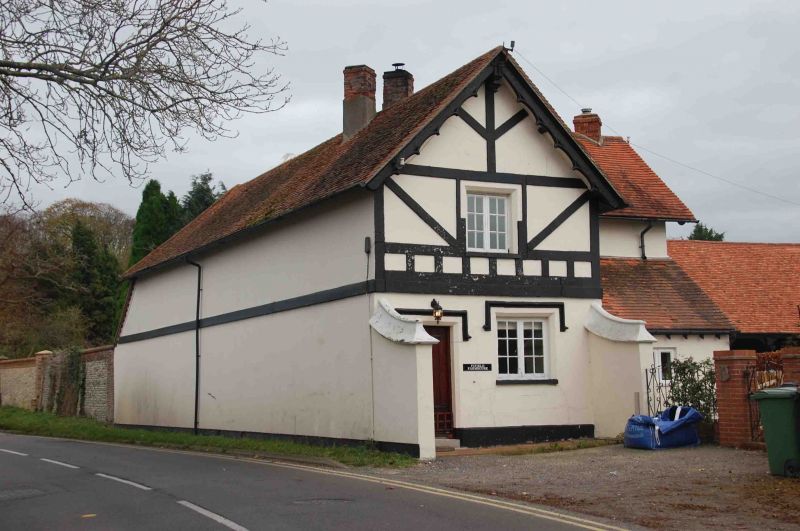
Barn. Probably mid C18. Red brick with glazed headers in Flemish bond; old plain tile half-hipped roof with lead ridges. L-plan aisled barn of approx. 25 bays. 4 hipped midstreys with double plank doors to front and rear. Blocked ventilation slits. Right return has 3 hipped midstreys to front and rear. Curved principal roof most common rafters replaced. Subsidiary attached stables and sheltershed forming courtyard. Probably mid C18. Red brick with glazed headers in Flemish bond; old plain tile roof. Sheltershed with some blocked openings linking barn complex to farmhouse. Farmhouse probably mid C18 with C19 render to road and C19 fenestration to right return. Formerly farm buildings to Fifield Manor (q.v.).
Listing NGR: SU6306792068
External links are from the relevant listing authority and, where applicable, Wikidata. Wikidata IDs may be related buildings as well as this specific building. If you want to add or update a link, you will need to do so by editing the Wikidata entry.


Other nearby listed buildings