Latitude: 51.6467 / 51°38'48"N
Longitude: -1.1671 / 1°10'1"W
OS Eastings: 457722
OS Northings: 194543
OS Grid: SU577945
Mapcode National: GBR 90D.RQN
Mapcode Global: VHCY8.QVBZ
Plus Code: 9C3WJRWM+M4
Entry Name: The Old Forge
Listing Date: 18 July 1963
Last Amended: 14 May 1986
Grade: II
Source: Historic England
Source ID: 1369116
English Heritage Legacy ID: 248100
ID on this website: 101369116
Location: Dorchester, South Oxfordshire, OX10
County: Oxfordshire
District: South Oxfordshire
Civil Parish: Dorchester
Built-Up Area: Dorchester
Traditional County: Oxfordshire
Lieutenancy Area (Ceremonial County): Oxfordshire
Church of England Parish: Dorchester
Church of England Diocese: Oxford
Tagged with: Smithy
DORCHESTER HIGH STREET SU5794 (East side) 5/70 The Old Forge 18/07/63 (Formerly listed as Barn Gates)
GV II
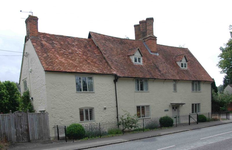
House. Late C17, extended C18. Rendered timber framing and colourwashed rubble with brick quoins; old plain-tile roof with brick stacks. 2-unit lobby-entry plan, extended. 2 storeys plus attics. Original 3 bays, on right of 4-window front, form an almost symmetrical arrangement with 6-panel door between 3-light casements, with casements of 3,1 and 3 lights at first floor, and with 2 small roof dormers flanking a central stack with 3 diagonal shafts. Later rubble bay has 3-light casements, at ground and first floors, and a gable stack. All windows have leaded lights. Right gable wall has further casements. Rear wall has some exposed framing.
Listing NGR: SU5772294543
External links are from the relevant listing authority and, where applicable, Wikidata. Wikidata IDs may be related buildings as well as this specific building. If you want to add or update a link, you will need to do so by editing the Wikidata entry.


Other nearby listed buildings