Latitude: 51.5446 / 51°32'40"N
Longitude: -0.9566 / 0°57'23"W
OS Eastings: 472449
OS Northings: 183374
OS Grid: SU724833
Mapcode National: GBR C4P.4Y3
Mapcode Global: VHDWF.CFMR
Plus Code: 9C3XG2VV+R8
Entry Name: Greys Court, the Keep
Listing Date: 24 October 1951
Last Amended: 13 February 1985
Grade: I
Source: Historic England
Source ID: 1369333
English Heritage Legacy ID: 247148
ID on this website: 101369333
Location: Greys Green, South Oxfordshire, RG9
County: Oxfordshire
District: South Oxfordshire
Civil Parish: Rotherfield Greys
Traditional County: Oxfordshire
Lieutenancy Area (Ceremonial County): Oxfordshire
Church of England Parish: Rotherfield Greys
Church of England Diocese: Oxford
Tagged with: Architectural structure
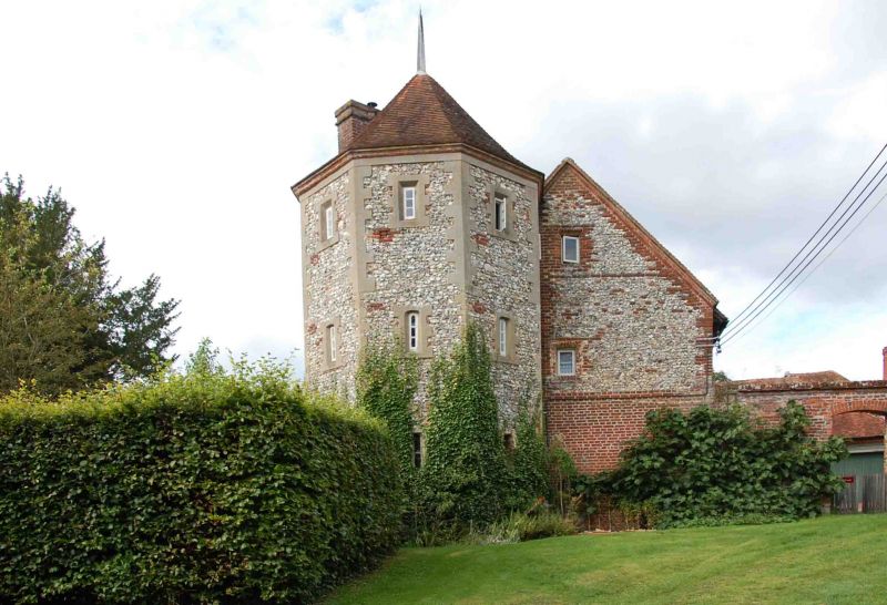
ROTHERFIELD GREYS SU78SW 6/126 Greys Court, The Keep 24/10/51 (Formerly listed as Greys Court including Batchelors Hall, The Well House, and Towers NE, NW and SW of house) GV I Keep. C14 tower with attached range with C16, C19 and C20 alterations. Flint with stone dressings to tower; flint with areas of brick to attached range; plain old tile roof; brick stacks. Octagonal tower with range. 3 storey tower with 2 storey and attic range. Slit window with moulded stone surround to each face of tower on each floor. Attached range has irregular mostly C19 or C20 fenestration, but window openings to gable end have possibly C17 brick surrounds. Interior not inspected. (Buildings of England : Oxfordshire, p.735-7; Greys Court, National Trust Guidebook, 1982).
Listing NGR: SU7244783381
External links are from the relevant listing authority and, where applicable, Wikidata. Wikidata IDs may be related buildings as well as this specific building. If you want to add or update a link, you will need to do so by editing the Wikidata entry.


Other nearby listed buildings