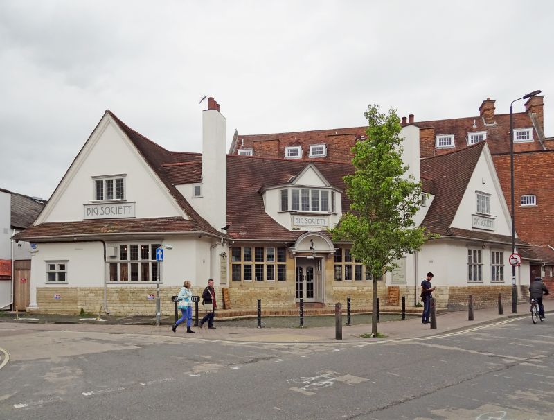
Latitude: 51.7486 / 51°44'54"N
Longitude: -1.2392 / 1°14'20"W
OS Eastings: 452621
OS Northings: 205813
OS Grid: SP526058
Mapcode National: GBR 8Z4.CJ3
Mapcode Global: VHCXV.G9RX
Plus Code: 9C3WPQX6+C8
Entry Name: The Elm Tree Public House
Listing Date: 28 June 1972
Grade: II
Source: Historic England
Source ID: 1369344
English Heritage Legacy ID: 245416
ID on this website: 101369344
Location: Headington Hill, Oxford, Oxfordshire, OX4
County: Oxfordshire
District: Oxford
Electoral Ward/Division: St Mary's
Parish: Non Civil Parish
Built-Up Area: Oxford
Traditional County: Oxfordshire
Lieutenancy Area (Ceremonial County): Oxfordshire
Church of England Parish: Oxford St Clement
Church of England Diocese: Oxford
Tagged with: Pub
1. COWLEY ROAD 1485 (North-East Side) The Elm Tree Public House SP 5205 19/707 II 2. 1902. By H T Hare. Stone plinth, rendered and painted above. 1 storey and attic, central block with angled wings. 5 light mullion and transom lattice windows on either side of central door, with tall hood over. 5 light window on left, 2 3-light windows on right. Central dormer. Steep pitched tile roof with 2 stacks.
Listing NGR: SP5262105813
External links are from the relevant listing authority and, where applicable, Wikidata. Wikidata IDs may be related buildings as well as this specific building. If you want to add or update a link, you will need to do so by editing the Wikidata entry.


Other nearby listed buildings