Latitude: 51.7659 / 51°45'57"N
Longitude: -1.2532 / 1°15'11"W
OS Eastings: 451631
OS Northings: 207728
OS Grid: SP516077
Mapcode National: GBR 8YY.7YX
Mapcode Global: VHCXN.7WB5
Plus Code: 9C3WQP8W+8P
Entry Name: Lady Margaret Hall, the Denake Building (East and West) and the Dining Hall
Listing Date: 28 June 1972
Last Amended: 14 November 1973
Grade: II
Source: Historic England
Source ID: 1369668
English Heritage Legacy ID: 244960
ID on this website: 101369668
Location: Park Town, Oxford, Oxfordshire, OX2
County: Oxfordshire
District: Oxford
Electoral Ward/Division: North
Parish: Non Civil Parish
Built-Up Area: Oxford
Traditional County: Oxfordshire
Lieutenancy Area (Ceremonial County): Oxfordshire
Church of England Parish: Oxford St Andrew
Church of England Diocese: Oxford
Tagged with: Architectural structure
SP 50 NW; 24/33B
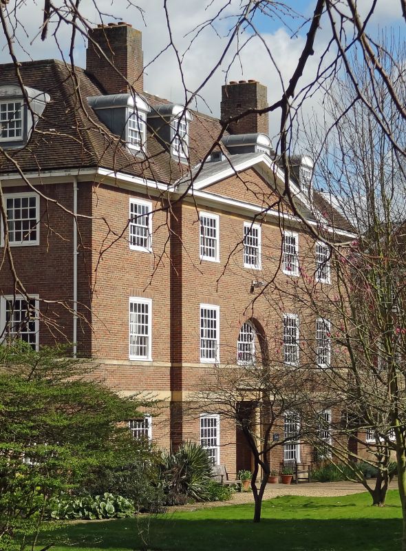
LADY MARGARET HALL,
The Denake Building (East and West) and the Dining Hall
II
1933. By Sir G G Scott. Red brick with stone dressings. Long, 3-storey
block with varied building line. Sash windows. Pedimented eaves. Hipped
tiled roof.
Listing NGR: SP5163107728
External links are from the relevant listing authority and, where applicable, Wikidata. Wikidata IDs may be related buildings as well as this specific building. If you want to add or update a link, you will need to do so by editing the Wikidata entry.


Other nearby listed buildings