Approximate Location Map
Large Map »
Latitude: 51.7507 / 51°45'2"N
Longitude: -1.2512 / 1°15'4"W
OS Eastings: 451788
OS Northings: 206042
OS Grid: SP517060
Mapcode National: GBR 8Z4.8HC
Mapcode Global: VHCXV.88D8
Plus Code: 9C3WQP2X+7G
Entry Name: Wall, West of Bastion 20
Listing Date: 12 January 1954
Grade: I
Source: Historic England
Source ID: 1369731
English Heritage Legacy ID: 245240
ID on this website: 101369731
Location: Oxford, Oxfordshire, OX1
County: Oxfordshire
District: Oxford
Electoral Ward/Division: Holywell
Parish: Non Civil Parish
Built-Up Area: Oxford
Traditional County: Oxfordshire
Lieutenancy Area (Ceremonial County): Oxfordshire
Church of England Parish: Oxford St Mary the Virgin with St Cross with St Peter-in-the-East,
Church of England Diocese: Oxford
Tagged with: Wall
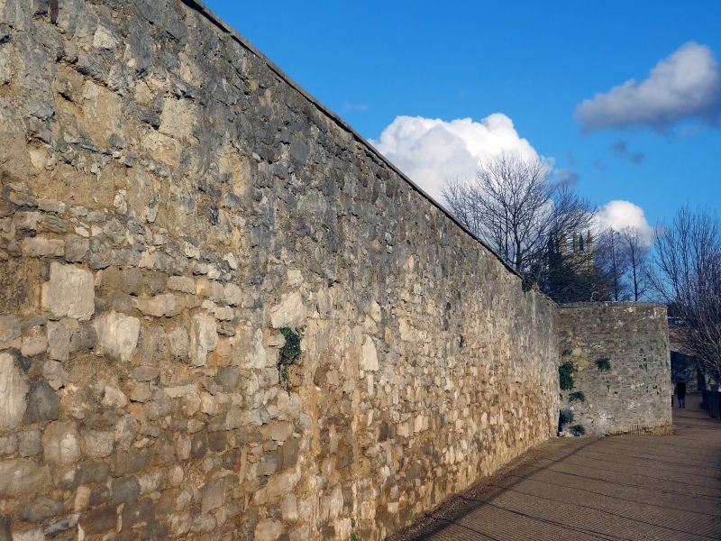
CITY WALL
1.
1485
Between South-East
angle and Christchurch
Wall, West of
Bastion 20
SP 5106 SE 9/477 12.1.54.
I
2.
Upper part rebuilt.
Listing NGR: SP5178806041
External links are from the relevant listing authority and, where applicable, Wikidata. Wikidata IDs may be related buildings as well as this specific building. If you want to add or update a link, you will need to do so by editing the Wikidata entry.


Other nearby listed buildings
