Approximate Location Map
Large Map »
Latitude: 53.1054 / 53°6'19"N
Longitude: -0.8376 / 0°50'15"W
OS Eastings: 477917
OS Northings: 357095
OS Grid: SK779570
Mapcode National: GBR BJW.C1S
Mapcode Global: WHFHH.36FP
Plus Code: 9C5X4546+4X
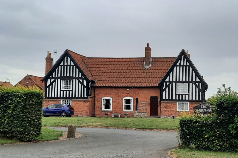
Entry Name: The Gables
Listing Date: 21 November 1974
Grade: II*
Source: Historic England
Source ID: 1369972
English Heritage Legacy ID: 242813
ID on this website: 101369972
Location: Little Carlton, Newark and Sherwood, Nottinghamshire, NG23
County: Nottinghamshire
District: Newark and Sherwood
Civil Parish: South Muskham
Traditional County: Nottinghamshire
Lieutenancy Area (Ceremonial County): Nottinghamshire
Church of England Parish: South Muskham
Church of England Diocese: Southwell and Nottingham
Tagged with: Architectural structure
SK 75 NE SOUTH MUSKHAM OLLERTON ROAD
(south side)
7/109 The Gables
21-11-74
II*
Farmhouse. c.1600. Altered C18 and C19. Timber framed, with
steep pitched plain tile roofs. Rubble and brick plinths, brick
nogging; partly rendered, with remains of pargetting at east
end. Tile hung north gables. Single coped gable with kneelers.
Single ridge and 2 gable stacks, one external. 2 storeys, 4
bays. Hall with 2 cross wings and cross passage. H-plan.
Windows unglazed at time of inspection. North front has a
projecting gabled wing at each end. Central bay has 2 C19
openings with rubbed brick segmental heads, and to left, a square
opening. To right, a panelled door with rubbed brick head and
overlight. To right again, a C20 casement. Above, a single
square opening in each gable, with moulded hood. West front has
corner post and timber sill to left. To their right, C19 door.
To right again, 2 windows, one with segmental head. Above, to
right, 2 windows. South west gable has to right a square opening
with rubbed brick head. Return angle has, above, an unglazed
casement. Rear elevation has to left, doorway flanked by brick
pilaster to right, and to its right, casement with segmental
head. Above, a square dormer. Partly demolished south east
gable has, to right, a square opening. Above, to left, an
opening with segmental head, and to right another opening, both
with rubbed brick heads. Interior has remains of 7 bays of
timber framing with 6 jowled posts, 4 posts with pegged jowls,
and an arch brace. Chamfered span beam with a broach stop.
Chamfered wall plate. Stud walls with reed and plaster finish.
Winder stair, c.1700. Timber framed smoke hood in south west
end. Principal rafter roof with tenoned collars and scarfed
tenoned purlins, and straight wind braces. Single C17 fireplace
in north east corner, ashlar, with chamfered four centred arched
head. Sources: Pevsner, Barley, M W The English Farmhouse and
Cottage.
Listing NGR: SK7791757095
External links are from the relevant listing authority and, where applicable, Wikidata. Wikidata IDs may be related buildings as well as this specific building. If you want to add or update a link, you will need to do so by editing the Wikidata entry.


Other nearby listed buildings
