Latitude: 53.084 / 53°5'2"N
Longitude: -0.9894 / 0°59'21"W
OS Eastings: 467789
OS Northings: 354560
OS Grid: SK677545
Mapcode National: GBR 9HK.NP8
Mapcode Global: WHFHD.SR14
Plus Code: 9C5X32M6+H6
Entry Name: Wagon and Horses Public House
Listing Date: 13 May 1986
Grade: II
Source: Historic England
Source ID: 1370204
English Heritage Legacy ID: 242158
ID on this website: 101370204
Location: Halam, Newark and Sherwood, Nottinghamshire, NG22
County: Nottinghamshire
District: Newark and Sherwood
Civil Parish: Halam
Built-Up Area: Halam
Traditional County: Nottinghamshire
Lieutenancy Area (Ceremonial County): Nottinghamshire
Church of England Parish: Halam
Church of England Diocese: Southwell and Nottingham
Tagged with: Pub
SK 65 SE HALAM THE TURNPIKE (west side)
7/103 Wagon and Horses Public House
G.V. II
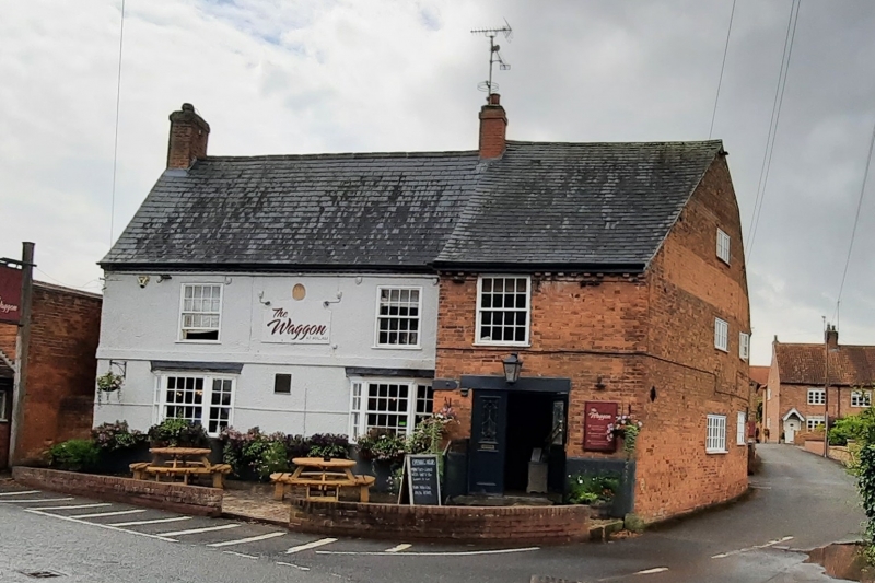
Public house. Dated 1752, with later C19 additions and alterations. Render over red brick, being roughcast above sill level and cement render below. Slate roof with pantiles to the rear. Single C20 ridge and left gable red brick stacks. Dogtooth eaves. 2 storeys plus garret, 2 bays. First floor band. 2 C19 canted bays each with single glazing bar sash, flanked by single similar smaller sashes. Above are 2 glazing bar sashes. Single central ashlar plaque inscribed "W.I.I. 1752". to the right and projectring is a C19 red brick and slate 2 storey, single bay wing with dentil eaves and cement rendered plinth. Doorway with C20 door and glazing bar marginal lights, above is a single glazing bar sash. To the rear are various 2 and single storey wings and extensions.
Listing NGR: SK6778954560
External links are from the relevant listing authority and, where applicable, Wikidata. Wikidata IDs may be related buildings as well as this specific building. If you want to add or update a link, you will need to do so by editing the Wikidata entry.


Other nearby listed buildings