Latitude: 53.0851 / 53°5'6"N
Longitude: -0.9748 / 0°58'29"W
OS Eastings: 468763
OS Northings: 354705
OS Grid: SK687547
Mapcode National: GBR BJX.LBZ
Mapcode Global: WHFHF.0Q27
Plus Code: 9C5X32PG+33
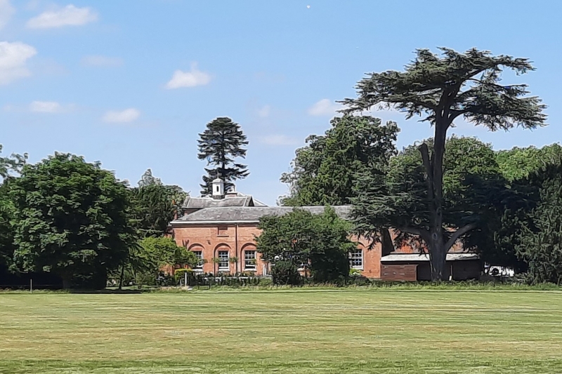
Entry Name: Former Stable Range at Norwood Park
Listing Date: 1 March 1991
Grade: II
Source: Historic England
Source ID: 1370211
English Heritage Legacy ID: 242283
ID on this website: 101370211
Location: Maythorne, Newark and Sherwood, Nottinghamshire, NG25
County: Nottinghamshire
District: Newark and Sherwood
Civil Parish: Southwell
Traditional County: Nottinghamshire
Lieutenancy Area (Ceremonial County): Nottinghamshire
Church of England Parish: Southwell St Mary the Virgin
Church of England Diocese: Southwell and Nottingham
Tagged with: Stable
SOUTHWELL
NORWOOD PARK SK6854 1919-0/5/215 Former stable range at Norwood Park 01/03/91 GV II
Former stable range, now garages, workshops and apple stores. Mid C18 and C19, converted to apple stores c1945. Brick with stone dressings and hipped and gabled slate and pantile roofs. Chamfered and rebated eaves. Windows are mainly glazing bar sashes. Single and 2 storeys; 9 window range. U-plan around stable yard. South west front, facing Norwood Park, has an off-centre single bay projecting block with a single window. Above it, a moulded pediment containing a clock, and above again, an octagonal wooden bell turret. Below, a moulded round headed doorway flanked by single blocked windows. To left, a block with 2 small windows and below, a door to left, with overlight, and a larger window to right. To left again, a taller water tower with 2 larger windows and below, to left, an altered doorway. To right, a window. To the right, a 2 storey block with 4 blanks on each floor. South east side has 3 blank windows and below them, 7 round headed recesses containing blank windows with rubbed brick heads. At the north east end, a hipped single storey carriage house. Single storey range to north west, facing the stable yard, has 4 stable doors and 4 slatted casements.
Listing NGR: SK6876354705
External links are from the relevant listing authority and, where applicable, Wikidata. Wikidata IDs may be related buildings as well as this specific building. If you want to add or update a link, you will need to do so by editing the Wikidata entry.


Other nearby listed buildings