Approximate Location Map
Large Map »
Latitude: 53.0774 / 53°4'38"N
Longitude: -0.9538 / 0°57'13"W
OS Eastings: 470180
OS Northings: 353862
OS Grid: SK701538
Mapcode National: GBR BK3.5N4
Mapcode Global: WHFHF.BX15
Plus Code: 9C5X32GW+XF
Entry Name: 2 Gateways and Boundary Wall at Minster Churchyard Adjoining Church Street
Listing Date: 11 August 1961
Last Amended: 20 May 1992
Grade: II
Source: Historic England
Source ID: 1370214
English Heritage Legacy ID: 242311
ID on this website: 101370214
Location: St Marys Minster, Southwell, Newark and Sherwood, Nottinghamshire, NG25
County: Nottinghamshire
District: Newark and Sherwood
Civil Parish: Southwell
Built-Up Area: Southwell
Traditional County: Nottinghamshire
Lieutenancy Area (Ceremonial County): Nottinghamshire
Church of England Parish: Southwell St Mary the Virgin
Church of England Diocese: Southwell and Nottingham
Tagged with: Building
SOUTHWELL
CHURCH STREET
SK7053
1919-0/11/21 (South side)
11/08/61 2 gateways and boundary wall at
Minster churchyard adjoining Church
Street
(Formerly Listed as:
CHURCH STREET
Minster graveyard wall and gateways)
GV II
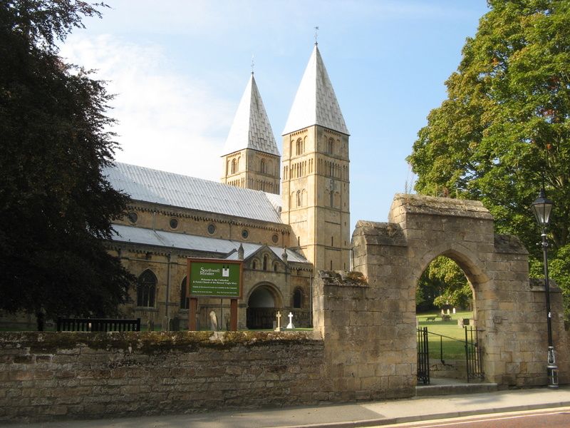
2 gateways and churchyard wall. C14, restored C19. Dressed
stone and ashlar. Wall, approx. 120M long, has gabled coping.
Each gateway has a stepped flat-topped gable and a plain round
headed opening. The left gateway is larger and has a pair of
wrought iron carriage gates. The smaller gateway has a gate
for walkers.
Listing NGR: SK7018053862
External links are from the relevant listing authority and, where applicable, Wikidata. Wikidata IDs may be related buildings as well as this specific building. If you want to add or update a link, you will need to do so by editing the Wikidata entry.


Other nearby listed buildings
