Latitude: 54.8423 / 54°50'32"N
Longitude: -1.9163 / 1°54'58"W
OS Eastings: 405475
OS Northings: 549725
OS Grid: NZ054497
Mapcode National: GBR HD1F.YY
Mapcode Global: WHB31.JKQ5
Plus Code: 9C6WR3RM+WF
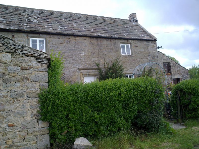
Entry Name: Crooked Oak Farmhouse
Listing Date: 18 June 1986
Grade: II
Source: Historic England
Source ID: 1370295
English Heritage Legacy ID: 240623
ID on this website: 101370295
Location: Northumberland, DH8
County: Northumberland
Civil Parish: Shotley Low Quarter
Traditional County: Northumberland
Lieutenancy Area (Ceremonial County): Northumberland
Church of England Parish: Shotley St John
Church of England Diocese: Newcastle
Tagged with: Farmhouse
SHOTLEY LOW QUARTER CROOKED OAK NZ 04 NE NZ 055497
21/252 Crooked Oak Farmhouse.
II
House, dated 1684 with initials TRI (Thomas Richardson and wife) on door surround. Rubble with cut dressings; stone slate roof, brick stacks. 2 storeys, 2 wide bays. Central boarded door in lugged architrave with pulvinated frieze and moulded cornice; flanking 4-light chamfered mullioned windows with similar 2-light windows above, most mullions missing. On far left blocked door with small oval window (blocked) in monolithic surround inserted. Coped gables with end stacks rebuilt on old bases. Pent outshut to right has boarded door with boarded opening above. Outbuilding to left with asbestos roof, not of interest. Rear elevation: blocked opening with timber lintel above later outshut, probably to former stair wing.
Interior: Parlour fireplace with elaborate moulded surround inscribed JR 1717.
Listing NGR: NZ0547549725
External links are from the relevant listing authority and, where applicable, Wikidata. Wikidata IDs may be related buildings as well as this specific building. If you want to add or update a link, you will need to do so by editing the Wikidata entry.


Other nearby listed buildings