Approximate Location Map
Large Map »
Latitude: 55.2135 / 55°12'48"N
Longitude: -1.7879 / 1°47'16"W
OS Eastings: 413596
OS Northings: 591047
OS Grid: NZ135910
Mapcode National: GBR H8Y4.QX
Mapcode Global: WHC2H.H7V3
Plus Code: 9C7W6676+9V
Entry Name: Claverings Cross
Listing Date: 30 January 1986
Grade: II
Source: Historic England
Source ID: 1370644
English Heritage Legacy ID: 238381
ID on this website: 101370644
Location: Northumberland, NE65
County: Northumberland
Civil Parish: Netherwitton
Traditional County: Northumberland
Lieutenancy Area (Ceremonial County): Northumberland
Church of England Parish: Longhorsley St Helen
Church of England Diocese: Newcastle
Tagged with: Architectural structure Wayside cross
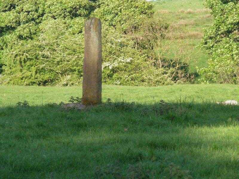
NETHERWITTON STANTON
NZ 19 SW NZ 136911
5/148 Clavering's Cross
II
Cross, medieval. Stone. Square shaft with chamfered angles and continuous
groove down south face, broken off1.5m. above base. Square plinth of
roughly-shaped blocks. The cross head is reputed to be buried in the dike
on the west side of the field.
Listing NGR: NZ1359691047
External links are from the relevant listing authority and, where applicable, Wikidata. Wikidata IDs may be related buildings as well as this specific building. If you want to add or update a link, you will need to do so by editing the Wikidata entry.


Other nearby listed buildings
